Cocos Keeling Island
October 10, 2006
Position: 10 53.3 S 103 09.1 E
We left Christmas Island yesterday morning (Tuesday) at 0930 hours local time and are sailing a rhumb line course for Cocos Keeling. All well on board.
We dropped our mooring and set sail at 0930 hours. As we cruised along the northern shore of the island, our scuba diving friends came by with the dive boat to wave and yell "goodbye" and to wish us
a safe passage. A little lumpy as we passed the northern tip of the island and then we picked up the trade winds and beam

 reached for the rest of the day under full sail. For the first two hours after we left C.I., we were circled by perhaps 200 boobies. There were red footed, blue footed, and brown footed boobies.
They passed within inches of the forestay. The had close mid-air "almost" collisions with each other. They plunged into the water next to DoodleBug. Landed ahead of
us in rafts on the water and then took off at the last minute. An extraordinary sight. They seemed to be playing and we have seen no evidence of any fishing industry here - did they think we were a
fishing trawler? Nevertheless a great send-off.
reached for the rest of the day under full sail. For the first two hours after we left C.I., we were circled by perhaps 200 boobies. There were red footed, blue footed, and brown footed boobies.
They passed within inches of the forestay. The had close mid-air "almost" collisions with each other. They plunged into the water next to DoodleBug. Landed ahead of
us in rafts on the water and then took off at the last minute. An extraordinary sight. They seemed to be playing and we have seen no evidence of any fishing industry here - did they think we were a
fishing trawler? Nevertheless a great send-off.
October 11, 2006
This morning showed that we had run 183 miles in the previous 24 hours and we were still under full sail and moving at better than 8 knots over the ground. We were
visited by four or five "Golden Bosun's". They are a yellow breasted sea-bird with a distinctive long tail. The sea is a little rolly but another pleasant day. Thursday night and
Friday are forecast to be less than pleasant with big seas and high winds. At the rate we are sailing, we will arrive at Cocos Keeling far too early, perhaps around mid-night Thursday. We plan
to "heave to" for the night in the forecast rough seas and high winds and to make our reef entrance in good light.
At sometime tonight, we will pass the 100 degree east line of longitude. This represents the half way point of our circumnavigation around the world.
The celebration will have to hold off until we get to Cocas however, as the Indian Ocean is a little rough for champagne toasting.
Position: 11 33.1 S 99 39.8 E
This is 166 miles from Cocos Keeling and we should arrive tonight (Friday morning) at around 0200 hours. We passed the "halfway around the world" mark this
morning at 0320 hours local time.
October 12, 2006
Position: 12 05.7 S 96 52.3 E
Just an update on our position as of 10/12/2006 at 1700 UTM: (0130 hours local time on Friday 13th.).We arrived safely at Cocos Keeling Island last night and are
anchored at Position: 12 05.7 S 096 52.3 E
A day of milestones! At 0320 hours local time, we passed the "half-way around the world" point, that is, the 100 degrees East line of longitude. I went to the back
cabin to tell Annette but she was sound asleep and would probably not have appreciated this information, as there was absolutely nothing to be seen in the heaving darkness that was the
Indian Ocean. The wind has been blowing quite strongly and was forecast to increase in intensity today, becoming positively ugly by nightfall. At 0930 hours, we logged a 24 hours distance run of
208 miles. Our previous best was 193 miles that we have reached twice before. We have been sailing a broad reach in the previous 24 hours with winds in the range of 17 knots to
18 knots. The swells have been in the 6 to 8 foot range and we seem to have been helped by about 2 knots of current. The pilot chart indicates perhaps a knot of current but, hey -
whatever works.
Well all that excitement was this morning. Now the forecast winds have arrived with winds in the range of 18 to 24 knots. The swells have been building all day
and tower menacingly over us in the 10 to 12 foot range. We have kept full sail up just occasionally dropping the mainsail when our speed becomes excessive and we start shipping a lot of
spray. The forecast for tonight is for winds of up to 30 knots and 16 foot seas. DoodleBug is screaming over the ground and rapidly approaching Cocos Keeling Island.
The guide warns about attempting a night passage but we assume that with a radar and chart plotter approach, we can push the envelope a little. Our first navigation marker, that is the beacon at the
west end of the island, was nowhere to be found (it has been broken for nearly three months). The range lights were also not to be found. There was a scattering of yellow, green, and red flashing
lights in the lagoon. We turned to pass through the reef and the lights began to sort themselves out. We found two yellow lights that matched the flash pattern of the range lights and lined up on
these (they are white lights according to the charts and the cruising guide). We had been warned of "bombies" (ship busting coral pinnacles) all over the lagoon but rationalized that
nobody could set up range lights in line with a known bombie. When we had entered the lagoon, we turned towards Direction Island and edged forwards into a 30 knot headwind until we had reached our
chosen anchoring spot in about 30 feet of water. The wind howled through the rigging and the short choppy waves hissed down the side of DoodleBug but, we were now pointed into the wind and waves
and had the anchor down and set at 12 05.7 S 096 52.3 E at 0145 hours local time. Annette had been on the bow with the purpose of checking the anchor chain tension but had been thoroughly
distracted by a bright shooting star. There was little motion on board as we celebrated with a late snack and well deserved beer before heading for bed.
October 13, 2006
Position: 12 05.5 S 96 53.0 E
This morning we chatted to the Customs and also talked to one of the anchored vessels in the inner lagoon of Direction Island regarding the navigation markers
and route through the secondary reef. We raised anchor, motored into a 30 knot headwind and after a scary passage between two dark patches of coral, re-anchored in 24 feet of water off the beach at
12 05.5 S 096 53.0 E. The anchoring procedure was decorated by a pod of perhaps 20 dolphins that gamboled and played across the bow and along our sides as we tried to pay attention to
the marine hazards. Right after the hook was set, Annette noticed a pair of sharks circling nearby but they looked small enough to eat and have been lauded as harmless by the locals. The
Customs boat arrived at 1000 hours but it was still too rough with the wind blowing at over 24 knots. He requested I take our documents ashore and meet him on the Island.
I beached our dinghy on a pristine white coral sand beach and headed up between the coconut trees to a picnic table and shelter. We are checked in! We are here! Cocos Keeling, Indian Ocean.
This morning as we were preparing to meet the policeman who handles customs and immigration, Noel the single hander we had met, called on the radio. I headed for the beach in
the dinghy and missed the conversation but essentially Noel pleaded to be allowed to visit Cocos Keeling and "Zack", the policeman, declined permission. I met "Zack" at the dock and he
said, "That fellow just told me he was 10 miles away but when I motored around the corner (of the islet) he was close enough that I could see him on board his yacht."
We were not entirely surprised that Noel had been refused permission to land, as he had already been refused permission before he left Christmas Island. We had been astonished when Noel
had called us on the VHF radio about an hour after we left Christmas Island and said he was just leaving and was behind us. I asked where he was headed and he stated that although he had been
denied a visa, he was also heading for Cocos Keeling and would have a "minor rigging failure" when he arrived so that he must put in for repairs. On these small islands,
anyone and everyone listens into VHF radio conversations just for entertainment and the customs man in Christmas Island is the supervisor for the Cocos Keeling Islands. Ouch!
Later that afternoon we explored the pristine beach of a deserted and uninhabited Island. There were three other yachts in the anchorage of which only one,
Canadian flagged "Amazon", is cruising. Dieter from Amazon joined us for sundowners. He is single handing and is headed for Mauritius in the morning. He had also heard the Noel / Customs
conversation this morning and he has met Noel before. He told us a tale of Noel insisting that Dieter winch Noel up the mast of Noel's yacht so that Noel could repair a burned out light. Now Noel is a
big lad and winching a heavy man up a mainmast is cardiac arrest type exercise. Dieter did this and later that evening Noel called him back on the radio to say that he had replaced the
bulb with the burned out bulb in error. Could Dieter winch him up the mast again? Dieter refused and Noel went into begging mode. Dieter relented and performed the arduous task again. Noel
afterwards said that the bulb was OK, he had hit the wrong switch. I told Dieter that Noel had also asked me to winch him up the mast to fix his light at the Christmas Island anchorage. (BTW, Dieter is
physically more imposing than Ed) At the time, I did not say anything. The following morning, I had climbed our mast in the Christmas Island anchorage to fix our deck flood and had been
knocked around considerably by the swell. I had then told Noel that it was dangerous for him to go up his mast in such
 conditions and he should wait until he got to a calmer anchorage. He had responded that it wasn't necessary after all. He had discovered that he had hit the wrong switch. Sound familiar? We
chortled while Dieter gnashed his teeth between guffaws. We toasted Noel in absentia and wished him "Fair Winds".
conditions and he should wait until he got to a calmer anchorage. He had responded that it wasn't necessary after all. He had discovered that he had hit the wrong switch. Sound familiar? We
chortled while Dieter gnashed his teeth between guffaws. We toasted Noel in absentia and wished him "Fair Winds".
October 14, 2006
Annette and I walked "our" completely deserted island with the only tracks being those of hermit crabs on the white sand between the coconut palms. The
sounds were of waves lapping on the beach, wind through the tree-tops, and the crowing of feral chickens somewhere in the bush. At 0945 hours, the island was transformed with the arrival
of the inter-island ferry. It disgorged perhaps 50 people clutching coolers, beach chairs, umbrellas, and with seeming hordes of small children. The crowd from "West Island" had arrived for
their
 Saturday picnic. At 1500 hours, the ferry returned and the horde re-embarked and silence descended again. In the interim, Ed had snorkeled under DoodleBug to inspect the hull, propeller,
and anode condition and was met immediately by a four foot reef shark. I dove down and swam directly at it. It swam away. I turned my back, it came back - sort of like your neighbors
irritating terrier dog. Annette in the meantime had swam over to visit our neighbors, Diane and Bea on "Sortilege". She was followed by
Saturday picnic. At 1500 hours, the ferry returned and the horde re-embarked and silence descended again. In the interim, Ed had snorkeled under DoodleBug to inspect the hull, propeller,
and anode condition and was met immediately by a four foot reef shark. I dove down and swam directly at it. It swam away. I turned my back, it came back - sort of like your neighbors
irritating terrier dog. Annette in the meantime had swam over to visit our neighbors, Diane and Bea on "Sortilege". She was followed by
 a reef shark (same one?) and it then followed her as she swam ashore. Annette was on a mission to get some coconuts and after she had found a couple, had expended a fair amount of sweat
husking them on a large spike embedded in a tree trunk on the beach. Later that evening, we visited Sortilege. Bea had fallen while attempting to board their dinghy at night after a beach
party. He had broken one or more ribs a day or so before our arrival but was hurting too badly to make it over to the doctor on the next island. Bea and Diane have spent months at this
anchorage every year for the past seven years. They have also visited our next destination of Chagos. Apparently the rats there are quite unintimidated by human presence and their theft of food
is quite brazen. Diane impressed Annette of how she had been sitting with a group one evening when a rat had stolen her food from her plate. At the time, blonde-haired, tanned and svelte
Diane was bare breasted and wearing a leopard skin sarong. (She would have looked fabulous). She had grabbed a coconut cleaving tomahawk and had hurled it at the rat, cleaving same. All the guys
were impressed. The following evening, everyone at the Chagos sundowner gathering were similarly armed.
a reef shark (same one?) and it then followed her as she swam ashore. Annette was on a mission to get some coconuts and after she had found a couple, had expended a fair amount of sweat
husking them on a large spike embedded in a tree trunk on the beach. Later that evening, we visited Sortilege. Bea had fallen while attempting to board their dinghy at night after a beach
party. He had broken one or more ribs a day or so before our arrival but was hurting too badly to make it over to the doctor on the next island. Bea and Diane have spent months at this
anchorage every year for the past seven years. They have also visited our next destination of Chagos. Apparently the rats there are quite unintimidated by human presence and their theft of food
is quite brazen. Diane impressed Annette of how she had been sitting with a group one evening when a rat had stolen her food from her plate. At the time, blonde-haired, tanned and svelte
Diane was bare breasted and wearing a leopard skin sarong. (She would have looked fabulous). She had grabbed a coconut cleaving tomahawk and had hurled it at the rat, cleaving same. All the guys
were impressed. The following evening, everyone at the Chagos sundowner gathering were similarly armed.


October 15, 2006
Today we managed to get a phone card to work and used the telephone that was in the beach shelter about 100 yards from where Doodlebug is anchored. I doubt
whether we will ever have such an exotic phone booth again.
 The island is deserted again and we have determined that the ferry only comes here on Saturday. Annette and I then snorkeled the famous "Rip" on the west end of
the island. This is a marine preserve and is a narrow channel that cuts between Direction Island and nearby Prison Island. The Rip has a coral reef on it's far side with the lagoon on the near side.
It flows at perhaps four or five knots and it is impossible to swim against the main current. The technique is to launch yourself into the middle of this and just let the current sweep you along.
The quantity of fish in the "Rip" is astonishing: huge, small, multi-colored, and in profusion. The channel was perhaps 30 feet deep at it's deepest and we were
The island is deserted again and we have determined that the ferry only comes here on Saturday. Annette and I then snorkeled the famous "Rip" on the west end of
the island. This is a marine preserve and is a narrow channel that cuts between Direction Island and nearby Prison Island. The Rip has a coral reef on it's far side with the lagoon on the near side.
It flows at perhaps four or five knots and it is impossible to swim against the main current. The technique is to launch yourself into the middle of this and just let the current sweep you along.
The quantity of fish in the "Rip" is astonishing: huge, small, multi-colored, and in profusion. The channel was perhaps 30 feet deep at it's deepest and we were
 able to free dive to see under the overhanging reef as we were swept by. We saw "sleeping" sharks in the caves under the reef as well as non-sleeping sharks swimming in
the blue. We had been assured that with the quantity of food available to them, they would not be interested in us. There were giant clams and great corals everywhere. As we were swept
further into the bay, we swam at right angles to the current and soon found ourselves in shallower and calmer water and able to swim back to the Island. We swam the Rip a couple of times and vow to
return with a submarine camera. What a ride!
able to free dive to see under the overhanging reef as we were swept by. We saw "sleeping" sharks in the caves under the reef as well as non-sleeping sharks swimming in
the blue. We had been assured that with the quantity of food available to them, they would not be interested in us. There were giant clams and great corals everywhere. As we were swept
further into the bay, we swam at right angles to the current and soon found ourselves in shallower and calmer water and able to swim back to the Island. We swam the Rip a couple of times and vow to
return with a submarine camera. What a ride!
October 16, 2006
We awoke this morning to pouring rain. The shower did not last long but this is the first time we have been
 rained upon since we sat out a gale while at anchor in Marchinbar Bay, back in May of this year. Today is our pilgrimage to "Home" Island, a small island about one and a half
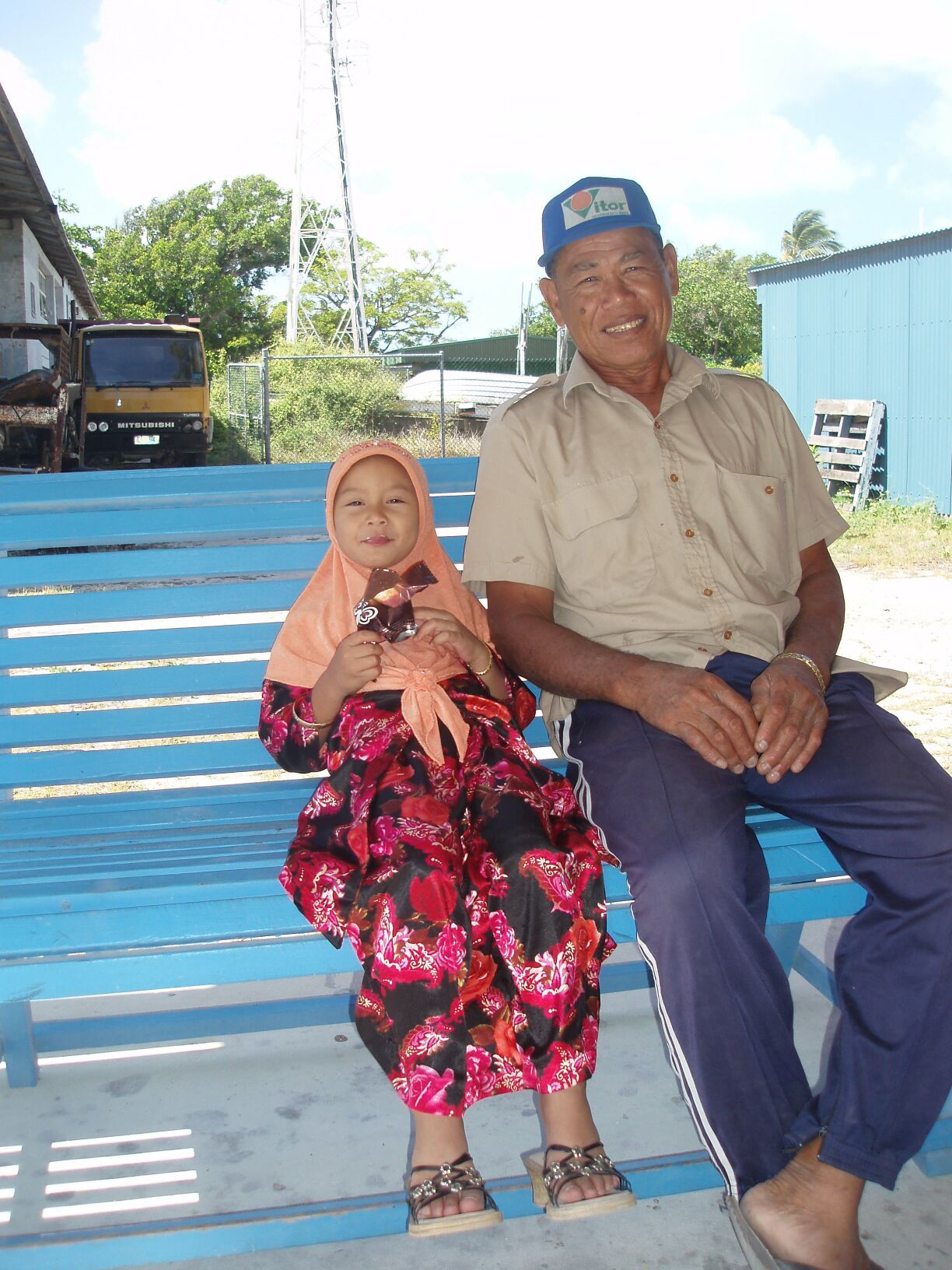
miles from where are now anchored. Home Island is home to a population of some 600 islanders of Malay origin. We assume that these Malays are the descendants of the original labor force. We
had received literature from the Customs officer when we arrived asking us to respect their Moslem modesty and to wear appropriate clothing so that shoulders, midriffs, and thighs were covered.
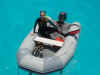
Thus we were now seated in a bouncing dinghy, trying to make the bumpy passage between the islands and using an umbrella to keep our "modest" clothing dry. Slightly damp, we landed on a
beach and made our way inland to find the fuel depot. The islanders we saw were riding around on 4 wheel ATV type motorcycles. The women were all garbed from head to foot in the same style of Moslem
dress we had seen in Java. We were told that 30 years or so ago, the women wore sarongs and were usually bare breasted. Then some Imam from Indonesia showed up and threw a hissy. I suppose the same
thing happened to the Polynesian Islanders a couple of centuries ago, when the Christian Missionaries showed up. At least these poor blighters don't have to wear Scottish woolens in the
tropical heat.
rained upon since we sat out a gale while at anchor in Marchinbar Bay, back in May of this year. Today is our pilgrimage to "Home" Island, a small island about one and a half
miles from where are now anchored. Home Island is home to a population of some 600 islanders of Malay origin. We assume that these Malays are the descendants of the original labor force. We
had received literature from the Customs officer when we arrived asking us to respect their Moslem modesty and to wear appropriate clothing so that shoulders, midriffs, and thighs were covered.
Thus we were now seated in a bouncing dinghy, trying to make the bumpy passage between the islands and using an umbrella to keep our "modest" clothing dry. Slightly damp, we landed on a
beach and made our way inland to find the fuel depot. The islanders we saw were riding around on 4 wheel ATV type motorcycles. The women were all garbed from head to foot in the same style of Moslem
dress we had seen in Java. We were told that 30 years or so ago, the women wore sarongs and were usually bare breasted. Then some Imam from Indonesia showed up and threw a hissy. I suppose the same
thing happened to the Polynesian Islanders a couple of centuries ago, when the Christian Missionaries showed up. At least these poor blighters don't have to wear Scottish woolens in the
tropical heat.


Everyone we met seemed pretty miserable and guarded but then it is Ramadan and they cannot eat until after sunset. After we bought our fuel, we hit the
grocery store and the Internet. The Internet facility had a dozen
 or more late model Dell computers, was air conditioned, and full of sneaky mosquitoes under the desktops. It was also deserted. Perhaps the kids fill the place after school is out.
We returned to our dinghy and discovered that in our absence, someone had ripped off one of the oars. This is a nuisance as it is hard to row with one oar and there is no place to buy another oar. We
felt somewhat violated, as we were wearing silly, uncomfortable, and wet clothing to show respect for their culture and had just suffered our first theft loss in our three years of cruising.
During the brief time we were on Home Island we saw no sign of any industry or agriculture. The "other" populated island is "West"
Island which has tourist resorts, clubs, dive shops, and restaurants. Apparently, the Australian welfare payments are so attractive, that only a few Home Islanders choose to work there.
That evening we joined neighbor Diane on the beach to drink wine and watch the sunset. (Bea is still too sore from broken ribs to make a dinghy ride). At dusk, we
were amazed at the sudden burst of activity by the
 residents. Crabs began running across the beach and digging in the sand. A large hermit crab - baseball sized - began eating some peanuts we had dropped and a rat ran out from under the coconut
fronds on the jungle floor and began to scavenge around us. Cool!
residents. Crabs began running across the beach and digging in the sand. A large hermit crab - baseball sized - began eating some peanuts we had dropped and a rat ran out from under the coconut
fronds on the jungle floor and began to scavenge around us. Cool!
Cocos Keeling background: Captain William Keeling reported the island's existence in 1609 but, they were not settled until 1826, when John Clunies-Ross
imported labor from Malaya and built a copra plantation. We know that the island was short of top-soil, because they had been bringing it from Christmas Island - that is until the Christmas
Island topsoil was found to be high grade phosphate. In WWI, the cable station on Direction Island (where we are anchored) was blown up by a party from the German cruiser, the Emden. The Australian
heavy cruiser the "Sydney" was escorting the ANZAC troop convoys and spun off from this task to track the Emden down. After a one-sided sea battle, the German
Captain ran the badly damaged Emden ashore on North Keeling, where the wreck still lies. The history of Cocos Keeling in WWII is a bit fuzzy, probably because it is still uncomfortable for
people to face. It appears that the Sikh soldiers on Cocos Keeling mutinied when a Japanese task force approached, as did the soldiers at Christmas Island. At Christmas Island, the troops
murdered their British officers and attempted to surrender to the Japanese. I don't know the fate of the Cocos Keeling officers but it probably wasn't too great.
October 17, 2006
We bounced across the water in a very wet dinghy ride to Home Island this morning and caught the ferry to West Island. At West Island we caught the local bus for
the four mile journey to the settlement. We had a surprisingly good breakfast at the only restaurant that was open, despite the surly reception we received from the cook / waitress. After
gaining their attention in the empty restaurant, we were snapped at - "You do realize that we do not serve bacon or pork products?". "...OK...".We bought three cases of beer plus
groceries and hauled this load back to DoodleBug via bus, ferry and wet dinghy ride. The highlight of the whole trip was seeing eight elephants in a field on our return bus trip. The elephants are in
transit to Australia and are being held in quarantine on the Island.


In the afternoon, we walked the shore on the windward side of the island. Apparently there was once a large community living on Direction Island. The Australian
government made the decision to relocate the community to
 Home Island and, to terminate any discussion, bulldozed all of the existing buildings into the sea on the very shore we were walking on. The jungle has reclaimed most of
the bulldozer scars but, the sea contains a jumble of broken concrete slabs, brickwork and rusting steel girders plus, interesting and unidentifiable pieces of machinery. On this
strand there were also a thousand or so flip-flops. This particular type of flotsam outnumbered all other varieties by perhaps five to one.
Home Island and, to terminate any discussion, bulldozed all of the existing buildings into the sea on the very shore we were walking on. The jungle has reclaimed most of
the bulldozer scars but, the sea contains a jumble of broken concrete slabs, brickwork and rusting steel girders plus, interesting and unidentifiable pieces of machinery. On this
strand there were also a thousand or so flip-flops. This particular type of flotsam outnumbered all other varieties by perhaps five to one.
 Where do they all come from? There were flip-flops of every size, color and style imaginable. I even found a matching pair of "platform" flip-flops.
October 18, 2006
Boat chores day. A recently purchased fishing boat in transit to it's new owners in Copenhagen arrived. The crew picnicked on "our" beach for the evening. They
arrived perhaps twenty minutes after Annette had returned from a "nude" swim to that same beach. That evening we met Diane and Bea from Sortilege for a beach
barbeque. This was Bea's first trip off their boat since his injury at their last beach party! The mosquitoes were absent and since we are awaiting the new moon signaling the end of Ramadan, the
stars were bright and challenged only by the sparks from our coconut frond fire.


October 19, 2006 thru October 21, 2006
On Thursday we made a "calling card" for the beach shelter on Direction Island. The shelter has been "decorated" for well over a
decade, with homemade signs from "found" objects on the beach by the various yachts that have called here. We had found a piece of timber of unknown origin and I
(Ed) spent several hours with hammer and wood-chisels, carving "DoodleBug, USA" onto it. Annette had designed the message and the reverse side does say "Ed and
Annette, Santa Fe, New Mexico" and "Oct 2006". This will all be bleached out in a year or so but the carved side will take several decades to decay. While Ed did
this task Annette tried to weave screens and baskets from palm fronds. She has now decided to keep her "day" job. Friday was back over to Home Island for a last jerry jug of diesel fuel,
last check of the internet, and last grocery shop. The ride was bumpy in the dinghy on both passages but we have worked out that if we wear "emergency ponchos" - little more than
plastic bags - we can arrive with just damp clothing instead of soaked clothing. Friday was also the


 day to burn our trash ashore in the designated pit and then hang our "DoodleBug" sign in the shelter. This took some effort, plus several beers, some thought and several failed attempts.
Finally it was done and the sign now hangs on Direction Island, Cocos Keeling for all to see. Saturday morning at 0730 hours local time, we set sail for the Salomon Islands in the Chagos
Archipelago. This will be a 1,520 mile run. We will cross the main cyclone path in the Southern Indian Ocean. Peak cyclone activity is still a month or so away and we have a clear forecast
so far.
day to burn our trash ashore in the designated pit and then hang our "DoodleBug" sign in the shelter. This took some effort, plus several beers, some thought and several failed attempts.
Finally it was done and the sign now hangs on Direction Island, Cocos Keeling for all to see. Saturday morning at 0730 hours local time, we set sail for the Salomon Islands in the Chagos
Archipelago. This will be a 1,520 mile run. We will cross the main cyclone path in the Southern Indian Ocean. Peak cyclone activity is still a month or so away and we have a clear forecast
so far.


 reached for the rest of the day under full sail. For the first two hours after we left C.I., we were circled by perhaps 200 boobies. There were red footed, blue footed, and brown footed boobies.
They passed within inches of the forestay. The had close mid-air "almost" collisions with each other. They plunged into the water next to DoodleBug. Landed ahead of
us in rafts on the water and then took off at the last minute. An extraordinary sight. They seemed to be playing and we have seen no evidence of any fishing industry here - did they think we were a
fishing trawler? Nevertheless a great send-off.
reached for the rest of the day under full sail. For the first two hours after we left C.I., we were circled by perhaps 200 boobies. There were red footed, blue footed, and brown footed boobies.
They passed within inches of the forestay. The had close mid-air "almost" collisions with each other. They plunged into the water next to DoodleBug. Landed ahead of
us in rafts on the water and then took off at the last minute. An extraordinary sight. They seemed to be playing and we have seen no evidence of any fishing industry here - did they think we were a
fishing trawler? Nevertheless a great send-off.