Vanuatu
August 13, 2005
Position: 18 39.8 S 172 38.5 E
Waya is the most southerly of the Yasawa Islands and lies just north of Navadra, where
we were "personae non grata" two weeks ago. The anchorage is rugged with volcanic plugs in the background and as we raised anchor and left for the
Vanuatus, I could not help but be reminded of the Marquise Island anchorages, now thousands of miles to the east. We sailed from Waya in
company with Frank and Jan on S/V Freewind and have the same destination of the island of Tanna, 455 miles to the southwest. We had checked the weather
forecasts and all important "Grib" files carefully (these are a wind and pressure forecast file with a ".grb" extension). The Fiji marine forecast
warned of high winds and the Grib files indicated good winds from the southeast to east for two days and then light winds going into Tanna. We
expected the winds to increase as we motored from the shelter of Waya - but it never happened. Where was our nice south-easterly trade wind? As it was,
we had to motor for the next 24 hours with various light wind sail combinations, trying to eke any kind of push from the light breezes
emanating from the northeast - or 90 degrees from the forecast direction.
At 1030 hours Annette caught a 23" tuna on her trolling line but released it. We are loaded down with tuna and want another mahi-mahi. A call on the
VHF to Frank, to pass on this information, elicited a "drop dead!". Fishermen are so competitive! At 1800 hours a small pod of three whales
passed just off our bow. We identified them as Minke whales (possibly pilot whales but as there were only three in the pod, more likely Minke).
 At dawn on Saturday, the wind had increased and we had enough light and "awake" crew members, to fool around on deck setting the light weather
sails. We spotted Frank on the horizon three miles away. We also found a trapped halyard at the top of the mast. It took the best part of an hour to
free this and rig our Genoa, poled to port and our spinnaker (actually a "ballooner") poled to starboard. The engine was shut down and we were under
sail for the first time, at 6.3 knots with 10 knots of true wind from the stern. The radar was blank. Freewind was now nowhere to be seen. Our radio
check-in at 0900 hours showed that Frank was 11 miles behind DoodleBug, as he had "heaved to" to sort out his own jammed halyard and in the process
had knocked his deep-sea fishing pole over the side. Not a happy camper!
At dawn on Saturday, the wind had increased and we had enough light and "awake" crew members, to fool around on deck setting the light weather
sails. We spotted Frank on the horizon three miles away. We also found a trapped halyard at the top of the mast. It took the best part of an hour to
free this and rig our Genoa, poled to port and our spinnaker (actually a "ballooner") poled to starboard. The engine was shut down and we were under
sail for the first time, at 6.3 knots with 10 knots of true wind from the stern. The radar was blank. Freewind was now nowhere to be seen. Our radio
check-in at 0900 hours showed that Frank was 11 miles behind DoodleBug, as he had "heaved to" to sort out his own jammed halyard and in the process
had knocked his deep-sea fishing pole over the side. Not a happy camper!

Saturday was a warm clear day and a pleasant sail. At 1800 hours the wind died again and we were back on engine. We are currently motor-sailing with
184 miles to go. The moon set just after midnight and the stars now dominate the firmament. Annette and I alternate night watches and keep a tally of the
shooting stars.
August 14, 2005
Position: 19 31.5 S 169 29.8 E
On Saturday, Annette had managed to catch two more tuna on her trolling lines but had released them. She now wanted a
 mahi-mahi and was getting covetous of her freezer space.
 Early Sunday morning, I (Ed) was catching a quick nap in the stern cabin. When I awoke, I looked out of the rear window over the
stern, to see the sun bisected by the horizon and to see yet another fish on the trolling lines. This time it was a 19" yellow fin tuna - very fine
eating!
An hour later a second similarly sized yellowfin, obligingly invited itself to supper. These fish filleted down to eight servings and prompted a
re-evaluation of the freezer contents with a subsequent discharge of less desirable foodstuffs over the side.
Early Sunday morning, I (Ed) was catching a quick nap in the stern cabin. When I awoke, I looked out of the rear window over the
stern, to see the sun bisected by the horizon and to see yet another fish on the trolling lines. This time it was a 19" yellow fin tuna - very fine
eating!
An hour later a second similarly sized yellowfin, obligingly invited itself to supper. These fish filleted down to eight servings and prompted a
re-evaluation of the freezer contents with a subsequent discharge of less desirable foodstuffs over the side.
Despite the grib file prediction of no wind, we were able to sail for most of the day, although there were frequent sail changes and constant sail
trimming to maintain a good speed. Just after noon, a much larger tuna was caught and released. He was striped and Annette has been getting far
more particular. His arrival coincided with a wall of fast moving cloud signaling the predicted cold front. We spotted this in good time on
radar and were reefed down and on engine by the time it hit. As it turned out, the squall line contained a little over 20 knots of wind and some rain.
We were soon back under sail with at least some of Lautoka's grime now washed off the deck.


The wee hours of Monday morning found us in heavy rain and motoring slowly into a headwind. We were close to Tanna and need daylight to make an
approach to the anchorage. Visibility was so poor, I could not see S/V Freewind's lights when they were less than two miles away. The radar just
showed a huge red blob of rain clouds and although I was able to remove the blob using the radar's "rain filter" setting, I noticed that Freewind's
radar echo was also removed. So much for collision avoidance technology!. This provides a very uncomfortable feeling when groping towards an unknown
coastline in the dark and rain, when this is just where we are likely to meet shipping and local fishing vessels.
Dawn slowly crept up in a heavily overcast sky and revealed a rugged coastline protected by huge cliffs. One of the mountains was issuing a cloud
of steam that was in contrast to the grey of the sky and which we quickly identified as an active volcano called Yasur. We cautiously approached the
cliffs with swell crashing at their base, using waypoints for the anchorage, provided by an electronic yachting guide. The first waypoint was on land and
was obviously nonsense. Confused we headed back out to sea and cautiously felt our way into the small bay we could see, that already had a couple of
yachts at anchor. The other waypoints provided by the guide coincided with the bay entrance and although S/V Freewind briefly touched bottom, we used
this information to alter course and miss the entrance reef. By 0930 hours local time, we were anchored at: Position 19 31.5 S 169 29.8 E. I
re-checked the electronic guide and saw that it was published by the local brewery. Well! That explained the first waypoint problem.


August 15, 2005
Position: 19 31.5 S 169 29.8 E
Just anchored in Vanuatu. Will eat breakfast, take nap and e-mail log later.
Later that day...
Port Resolution was so named after Captain Cook anchored here in 1774. Since then, there have been multiple volcanic eruptions and the sea bed has lifted
to the point where deep draft vessels such as his, can no longer enter. As we were setting our anchor following our own arrival on Monday morning, an
outrigger canoe came by with a Tannan, who introduced himself as "Sam", plus a New Zealander and a Frenchman wearing wet-suits. I asked them about
check-in procedures and they explained that we had to cross the island to the port of Lanakel on the west coast. A truck was booked for the morrow and
Sam assured us that there would be room for both DoodleBug and Freewind crews to ride. Sam told us to meet the truck at 0730 hours at the "yacht
club". We had our late breakfast, a very necessary nap and then launched the dinghy to pick up Frank and Jan and all go ashore to explore.
The "yacht club" sits on a small headland and we dinghied around to the side where we found a beautiful white sand beach with some outrigger canoes
pulled up past the tide-line. We climbed a steep jungle trail up to the headland and discovered a small resort with a sign announcing it was the
"Port Resolution Yacht Club". The view of the little bay was spectacular with the black basalt cliffs, covered with the green of jungle, several
white sand beaches and our two ketches ("real" cruising boats as Frank calls them) riding quietly at anchor. We introduced ourselves to the few men
doing clean-up work at the yacht club and asked if they were open and if we could buy beer. The man we asked, "Werry", affirmed that they had beer for
sale but that they would need to start the generator to make it cold. Okay, beer later....We made reservations for a lobster dinner at the Yacht Club
for the following day and then walked to the village along a vehicle wide jungle trail, admiring the profusion of trees laden with fruit and the
exotic flowers mixed with the creepers, ferns and palms. A loud "thump" warned us of the Damoclesian risks of passing below laden coconut palms. The
trail opened out in a wide clearing of the village. At the edges of the clearing, buried back in the jungle were the grass huts of the Tannans. The
huts were lightly built of bamboo and pandanus with thatched roofs. The young men of the village were kicking a football (OK soccer ball...) between
them and there were groups of older men lazing on the grass watching.


Children, dogs and chickens were everywhere and the people seemed uniformly friendly and outgoing. There was no mobbing of the tourists and when Frank
began handing out candy to the smallest children, they were remarkably polite and restrained in their anxiety to receive their treat. We were
introduced to the "Commodore of the Yacht Club" who is also the village headman. His name is "Ronnie" and he is reputed to be 79 years old. He
seemed very concerned that we deal with his village in arranging tours and not with any of the other neighboring villages. We later walked back to the
yacht club for a few warm beers at sunset before searching the darkness by dinghy for our floating homes.
August 16, 2005
At 0700 hours we picked up Frank and Jan and dinghied back to the beach below the Yacht Club. When we arrived at the summit of the beach trail, Nelson, the
headman's nephew was also waiting for the 0730 truck. There is no taxi in Port Resolution so they telephone to Lanakel for a truck to be sent. 0730
hours came and went. The French and New Zealand cruiser's we had met the previous day were also absent. Nelson went to find out what happened to
the truck, while we in turn took a tour of the village guided by a lady named "Jocelyn", who lived a short distance from the village. She
explained that she is a Seventh Day Adventist but that there were many other strains of Christianity represented nearby. I noticed that she
walked under the heavily laden coconut palms without looking up. When I asked her about this, she said that the people there believe that you only
get hit by a coconut if you have done something bad. Since what constituted "bad" to the coconut gods was undefined, I decided to continue
to look up. She was very knowledgeable and informative and we plied her with questions about marriage, education, work, emigration etc. etc. We
asked about the risk from sharks when swimming. She concurred with previous statements that there was no risk at Port Resolution. Frank asked
her about the death of a 7 year old from a yacht two months earlier. The yachties had been warned by the locals not to swim there and the child was
told by her parents not to go in the water. She did jump from the yacht into the sea and was promptly gobbled up by a shark. Jocelyn announced
gravely that was not a shark but "bad magic". Frank did not think he had heard this correctly from the Seventh Day Adventist but she again repeated
her diagnosis. I later asked her what the villagers did to shelter from a cyclone. She said there is a large Nissen hut the villagers can shelter in
and that her husband burns some herbs to make the cyclones go away. She maintained that his herb burning has made previous cyclones jump
completely over their island. As we were discussing this, we passed the area where the men of the village gather daily to discuss important issues
and to drink kava. The kava here is much stronger than the Fijian variety. It is made in the traditional manner. That is, the roots are first chewed
by uncircumcised boys and then the pulp is mixed with water to produce the drink. Women are banned from the area and may neither participate in the
kava drinking nor see the men at this time. They are supposed to be home cooking supper and doing woman stuff.
Back to the village and Nelson announced a now 1000 hour truck. This meant that he had ordered a second vehicle. Despite the delay, we had a pleasant morning
exploring the culture of the islanders and were quite relaxed when the truck actually showed up as promised. There followed a wild ride to
Lenakel and back, that will remain forever in our memories as one of the best parts of cruising. The truck was the size of a medium pick-up and
crammed with 12 people in the bed, some standing and everyone hanging on for dear life. As the driver rocketed down a single vehicle wide jungle
trail, we craned our heads to see the enormous banyan trees, giant ferns, palms, bananas, all laden with vines and creepers in an almost
claustrophobic verdant background. The truck began to climb and we caught glimpses of the coastline below; the blue of the Pacific with other
islands on the horizon. The trail was washed out and muddy in places, with steep drop offs and no chance of survival if we slipped over the edge. The
trail then began to cross the flank of the cone of the volcano and we gazed up it's barren ash slope to the smoke and steam issuing from the
summit. It reminded me of a towering sand dune from the Sahara, as the ash on the edge we faced had been sculpted by the wind.


The truck then passed into the lee of the volcano and we drove over a barren ash plain, with no sign of life whatsoever - this in stark contrast
to the thick jungle on the other side of the volcano. We could now smell sulfurous fumes and the photographers in the swaying truck tried to stand
up for a better view, while the truck driver used the opportunity of the flat ash plain to drive even faster. Eventually we passed back into jungle
and began to descend from the spine of the island to the port of Lenakel. We drove first to the bank to obtain some local currency. There I saw the
New Zealander from last night. He mumbled about a mix-up this morning. He claimed he had gone to the other side of the bay to pick up laundry
and accidentally met the 0730 truck driver there instead of at the yacht club, where he knew we were waiting patiently. My thoughts were - "Thanks
for the help fellow-cruiser. If you begin to sink out on the ocean somewhere, be sure to call us on the radio so we can come to watch and
take pictures!".
 Our truck driver left to deliver one of the passengers to the airport and we walked to the Customs house nearby for the usual mundane and tedious
paperwork. Next stop was lunch for we needed a ride to the Immigration office and our truck had not yet returned. By the time we were ready to
leave, our driver had returned but decided he now needed his lunch. We left him and made to trip to the Immigration and Quarantine offices by
hiring the customs officer to drive us there in his truck. When we returned to the bank / restaurant area, the driver had completed his
repast and graciously consented to return us to Port Resolution. Another wild and hairy bone jolting ride!
Our truck driver left to deliver one of the passengers to the airport and we walked to the Customs house nearby for the usual mundane and tedious
paperwork. Next stop was lunch for we needed a ride to the Immigration office and our truck had not yet returned. By the time we were ready to
leave, our driver had returned but decided he now needed his lunch. We left him and made to trip to the Immigration and Quarantine offices by
hiring the customs officer to drive us there in his truck. When we returned to the bank / restaurant area, the driver had completed his
repast and graciously consented to return us to Port Resolution. Another wild and hairy bone jolting ride!
At 1900 hours we arrived at the Yacht Club for our promised lobster dinner. There was no smell of cooking - bad sign! Our supposed maitre de
appeared and fed us a line about it having been too rough for the men to hunt for lobster. This was a little hard to swallow, as we had to beat off
other villagers trying to sell us lobsters by explaining to them we already had a dinner reservation at the yacht club. We drank our beer and
wine we had carried with us to the yacht club and chatted to a couple from Paris, France who had just flown in to stay at the Club bungalows. Annette
liberally sprayed the Frenchman "Zarko" with insect repellant, while he squirmed and his wife applauded. Annette felt really badly afterwards,
when they explained there was no hot water at the resort to shower the muck off. More unwanted American interference!
August 17, 2005
This morning we had arranged to go lobster hunting with Nelson, the headman's nephew. The method here is to snorkel along the edge of the reef - just
about where the waves break and to spear the lobsters. Nelson assured us that sharks were not a problem but that if the surf was breaking heavily,
it would be dangerous to snorkel that close to the coral. We loaded up with bags full of flippers, masks, snorkels, wetsuits, fishing spears,
bug-spray etc. and hauled all this through the village to the opposite side of the headland, alleged to be prime lobster territory. When we
arrived, the breakers looked formidable and Nelson maintained that it was too dangerous.


We spent the morning doing a little beach combing and chatting to Nelson about his family and their prospects in Vanuatu - in a land of incredible
beauty and crushing poverty. Nelson is 26 and has 4 children. His 3 month old baby is their "last" child and he said he and his wife had planned
four children. She will now go to the hospital to get birth control pills, which are readily available. He has visited Auckland, New Zealand and is
quite aware of the outside world. Very few Vanuatans travel, as the government rigidly controls exit visas and permission to leave is expensive to obtain.
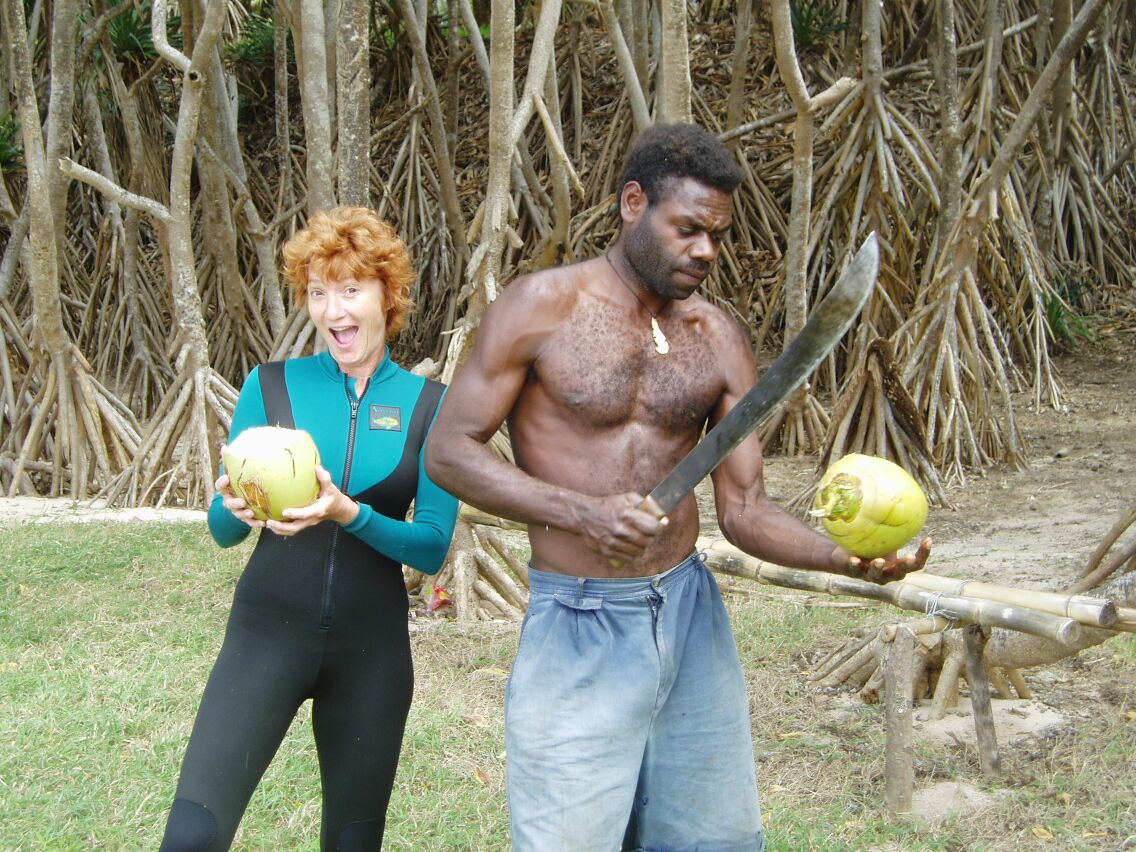
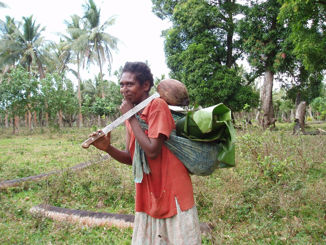
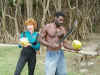
At mid-morning Nelson brought us fresh coconuts for a drink and opened them by holding them in his hand and cutting the tops off with exquisite
precision with a machete. We have marveled that many of the school children are wandering around the school grounds with machetes. (Try this
in the USA!). We have watched in horror as a toddler has staggered wobbly in front of us, grinning at us with a machete in his mouth. He was
"teething" on the dull side of the blade.
Nelson decided to check the lobster hunting conditions as the waves had died down slightly in intensity. We watched as he was hurled around like a
cork in a washtub for thirty minutes or so. He emerged from the sea lobsterless. He said he had seen several but there was too much sea action
to be able to hit them with a spear. A pleasant morning with a tuna sandwich for lunch back on DoodleBug - still no lobster.
In the late afternoon we boarded a truck to visit the volcano. We had yesterday's demon driver, Frank and Jan; the French couple we had met
yesterday and a Swedish couple on vacation from China. The truck climbed steeply up a muddy track, often in low ratio four wheel drive and broke
out of the jungle near the summit on the windward side of the volcano. Here we parked and hiked to the summit. Just as we reached the summit
there was a low roar, the ground shook and a huge cloud of steam and gases shot from the crater. It was as though the earth was breathing. We could
look down into the crater and when the wind blew the gases away, we could see to the opposite rim - perhaps a kilometer across(?). The bottom of the
crater was often a roiling mass of gases, sometimes steam like, sometimes dark and often distinctly bluish. We could smell sulfur and when the
mountain belched, we saw a flickering blue light pass through the clouds, like the shock wave you have seen on television of large aerial bombs
going off. The noise was deafening, primordial and provided a reminder of just where we stand in the scale of natural events. The largest eruptions
would hurl huge rocks or pieces of molten magma into the air and as it became dark (we were there at sunset) we could see the magma was glowing
cherry red. (We were very cognizant of the fact that in 1995, two tourists and a guide were killed by a piece of magma that hit them as they
watched). It then began to rain heavily and the cold wind drove us off the summit for another jolting, crazy ride back to the yacht club. An
unforgettable, exhilarating and humbling experience.


August 18, 2005

 Today was maintenance day and we spent the day doing boat chores. I serviced the main engine and transmission, thereby oiling up some of the clothing Annette had
just laundered. Messy job! In the afternoon we had invited the village chief "Ronnie" to visit us on our boat. Ronnie is 79 years old and a thin, frail
looking man. He came with his nephew Nelson and they arrived on the beach an hour later than our agreed time. We managed to get Ronnie on board DoodleBug
without dropping him in the sea and gave him fruit juice, cookies and a tour of DoodleBug. He said he had been on a yacht before but "in those days",
they had none of the electronics and computers. I think the previous yacht was Cook's "Resolution". We had a pleasant visit and after we returned
Ronnie and Nelson ashore, we were supposed to meet Frank and Jan aboard Freewind and then go on to a school fundraiser. The heavens opened and it
rained heavily for the next several hours. The school fundraiser was intended to be singing by the schoolchildren and the villagers had butchered
a goat in order to sell food to the attendees. It was a shame for both the schoolchildren and the goat that the event was a total washout.
Today was maintenance day and we spent the day doing boat chores. I serviced the main engine and transmission, thereby oiling up some of the clothing Annette had
just laundered. Messy job! In the afternoon we had invited the village chief "Ronnie" to visit us on our boat. Ronnie is 79 years old and a thin, frail
looking man. He came with his nephew Nelson and they arrived on the beach an hour later than our agreed time. We managed to get Ronnie on board DoodleBug
without dropping him in the sea and gave him fruit juice, cookies and a tour of DoodleBug. He said he had been on a yacht before but "in those days",
they had none of the electronics and computers. I think the previous yacht was Cook's "Resolution". We had a pleasant visit and after we returned
Ronnie and Nelson ashore, we were supposed to meet Frank and Jan aboard Freewind and then go on to a school fundraiser. The heavens opened and it
rained heavily for the next several hours. The school fundraiser was intended to be singing by the schoolchildren and the villagers had butchered
a goat in order to sell food to the attendees. It was a shame for both the schoolchildren and the goat that the event was a total washout.
August 19, 2005
Today we visited a "Custom Village" by truck. These are villages where the people rejected the teachings and cast off the clothes that the missionaries had
imposed upon them, returning to their traditional customs. The village men were clad in penis sheaths and nothing else. They performed several dances
for us accompanied by a singing chant and heavy foot stomping. They would also accompany their singing with a bamboo flute very similar to a "Pan"
flute. Our guide for this event was a 9 year old boy from Port Resolution village. His name was Johnny. I noticed that the language he was speaking to
the custom villagers sounded different from the Port Resolution language. I asked him how many different languages were spoken on Tanna. He said.
"Four". "And how many do you speak?"; "All of them". "And you speak Bislama?" (the national language of Tanna). "
Yes". Of course he was speaking English to us, so that meant the nine year old could speak six languages. Not bad...... The custom villagers then demonstrate how they hunt with bow
and arrow and how they make a fire by rubbing sticks together. I was truly astonished with the speed and ease that they produced a fire. (I am sure Tom
Hanks would have also been impressed).


Throughout the tour I had been under the impression that Johnny, our tour guide, was Nelson's son. He corrected us and maintained that he is Ronnie's
son. "Ronnie the chief is your father?". "Yes" If he is 9 and Ronnie is 79, then maybe Ronnie isn't as frail as he looks!
August 20, 2005
Position: 18 49.2 S 169 0.7 E
Erromanga Island. Very rolly anchorage. Will leave either tomorrow or following day from Port Vila.
Later that day...
0800 hours we raised anchor and set sail for Erromango, some 55 miles away to the northwest. The grib files promised 10 knots or so of southeast trade wind
and we expected a quiet sail to the next island. For the first four hours we had virtually no wind and had to motor. The day was pleasant and sunny but
it would have been nicer to have the engine off.
Around noon the wind sprang to life and gave us 20 knots from the southwest. A fast beam reach in a rolly, choppy sea but at least we were sailing!
Unfortunately our intended anchorage was open to the west and a southwest wind would probably render this unusable. We conferred with S/V Freewind by
radio and decided to continue to the anchorage to see if the wind shifted and possibly continue overnight to Port Vila if we were unable to anchor. At
1300 hours Annette had two fish on her trolling lines but by the time we boarded the first, the second had managed to escape. A nice sized yellowfin tuna!
We sailed along the South and West coasts of Erromango. The guide book describes the island as "untouristed". It is the fourth largest island in
the Vanuatus at 887 square kilometers and with a population of around 1200, has the lowest population density of any of the islands, with 1.4 persons
per square kilometer. (1989 statistics) As we traversed it's length, we saw towering basalt cliffs, heavily forested mountain ranges and not a single
sign of human habitation, until we arrived at Dillon's Bay.

 After an hour or so the wind did begin to swing towards the southeast and 1645 hours found us at anchor off Dillon's Bay Village. The anchorage was
rolly but we were not sufficiently impressed with the holding to put out a stern anchor. We were immediately visited by several outrigger canoes,
with villagers wanting to beg or trade - although they were always polite and did not show resentment when we said we would not give them whatever
they asked for. We went aboard Freewind where Frank barbequed Annette's yellowfin tune and the evening was punctuated by "hello's from outside, long
after it became dark. We promised to visit the village on the morrow if conditions permit.
After an hour or so the wind did begin to swing towards the southeast and 1645 hours found us at anchor off Dillon's Bay Village. The anchorage was
rolly but we were not sufficiently impressed with the holding to put out a stern anchor. We were immediately visited by several outrigger canoes,
with villagers wanting to beg or trade - although they were always polite and did not show resentment when we said we would not give them whatever
they asked for. We went aboard Freewind where Frank barbequed Annette's yellowfin tune and the evening was punctuated by "hello's from outside, long
after it became dark. We promised to visit the village on the morrow if conditions permit.
August 21, 2005
This morning we dinghied up the small river emptying out into the bay. We were looking for a suitable landing spot, in order to explore the village off
Dillon's Bay in Erromango. The guide book describes this place as the "one of the farthest ends of the earth". We had heard that the village has a
missionary - a Mr. Portley from Boston, who has determined to spend the rest of his life on this spot. We intended to visit him but discovered that he
had flown to Port Vila that very morning and would be absent for at least a week. The island is serviced by two flights per week of a small plane.
We had been told that the stands of sandalwood trees were being harvested and a local man "Eric" offered to guide us. Sandalwood was discovered here
in 1825 and was never harvested to any extent, so the resource remains relatively unpillaged. We followed our guide along a jungle trail
accompanied by some half dozen urchins from the village. By now, we have become more hardened to the continuous peppering of questions - "Do you have
any batteries? ..Diesel, Do you smoke? Do you have fishing line? trousers, shoes, underwear?" It makes us very much aware of the incredible wealth we
have displayed on and by our vessels and the poverty of the ni-Vanuatu. There is no electricity on Erromango. The village is alongside the
freshwater river and this is the source of water for bathing, washing clothes etc. Although the people are often wearing filthy rags, none looked
hungry. The climate is benign, the seas are abundant with fish and fruit and root vegetables grow everywhere in wild profusion. This poverty is in
contrast to what we would expect to find in countries like Egypt or India. What we have found tiresome, is that when you provide a gift of clothing,
food, fishing gear or whatever, it provokes a polite request for more items.
Eric showed us one or two sandalwood trees and then asked if we wanted to cross the river to see another village. After one or two false attempts, we
realized that the urchins who were by now bouncing around like a pack of monkeys, ripping fruit off the trees etc., knew their way around a sight
better than Eric. We forded the river and proceeded to visit "villages". These were in fact single family compounds. The homes were built of the
pandanus woven panels on a bamboo frame, that we had seen before on Tanna. Several of the homes had seedlings of sandalwood trees laid out in nursery
fashion under a protective tarpaulin. Eric maintained that when a sandalwood tree was harvested, the tree was immediately replaced by a seedling. He said
that the seedlings were provided by the government and if this is true, it is the first evidence we have seen of any contribution by the governance on
Efate to any island we have visited. The ni-Vanuatu (that what they call themselves) must pay for education at the tune of about 27,000 vatu per
child per year (about US$260). The minimum wage has just been raised to 20,000 vatu per month. Very few islanders had any form of employment and
since the cost of educating 6 children would be 8 or 9 months earnings per year, the highest illiteracy rate in the Pacific is quite understandable.


During the river crossing Annette's camera was dropped and bounced of a rock. Amazingly, it still seemed to work after the experience. By the time
we returned to our dinghy, the tide was out and we had to paddle downriver and then drag the dinghy over the bar at the bay entrance. We were in
Frank's dinghy with Annette and I sitting on the front of the dinghy holding oars. Frank ran into a huge rock and Annette shot off the dinghy bow, as
though she had been slingshotted and disappeared with a splash. Again! What a show off! With dampened clothes but undampened spirit, we drug her back on
board. The camera was of course in her pocket and although it had survived the rock bashing, it did not survive the swim. We have now determined that
we will sail overnight to Efate, some 85 miles to the northwest.
August 22, 2005
Position: 17 44.7 S 168 18.7 E
We "set sail" last night at sunset and discovered that we were also in company with "S/V Moonshadow" - a distant light on the horizon. "S/V Gumbo Ya-Ya"
was somewhere in VHF radio range heading the same direction. There was little wind and the trip became a motor-boat ride with perhaps 0.4 knot
benefit from the mainsail but at least it dampened the roll. The full moon rose behind Erromango around nine o'clock to wash out the fantastic
display of stars but provided enough light that one could almost read from it. The passage was uneventful until we reached the inner harbor at Port
Vila. Here we had to pass under a power line. The chart and sailing guides warned that no vessel with mast height greater than 22 meters should
attempt this. We are 20 meters plus another meter for the VHF antenna. This last meter isn't such a big deal for a bridge, because the antenna
bends - but this is a high-voltage line we pass below. Just as when we left Kemah, Texas, I couldn't see the clearance from the steering position
below the dodger but Annette maintained it was exciting.
August 23, 2005 - August 27, 2005
We spent five days at mooring in Port Vila. It is a littler reminiscent of Vavau in Tonga, with a yachtie bar and restaurant fifty yards from where we are
moored. The dinghy dock sprouts a score of dinghies with long twisted mooring lines. The technique is to shove your way into a gap when arriving
and push the other dinghies out of the way. You tie off to the dock with a long line and then everyone else can push you out of their way. Port-Vila
is crammed with banks, internet cafes, restaurants, super-markets, gift shops etc. and we have made full use of all. The streets are clean and
tidy and the people uniformly friendly. This must be the cleanest town we have visited in the Pacific.
We toured the national museum a short walk from the yacht club. They had several excellent exhibits but there is an aura of decay associated with
anything run by the Vanuatu government. The government has been run by the same group of chiefs for the 25 years since their independence. The style
of government is best described as a kleptocracy. One of their primary sources of income is as a tax free haven for offshore banking. Their
excesses for money laundering etc. have prompted the global community to threaten blacklisting the country and they hover on the edge of being a
pariah country, versus giving up this source of income. So far, we have seen no evidence of the revenues leaving the capital at Port-Vila for the
benefit of other islands.
August 28, 2005
Position: 17 33.1 S 168 16.9 E
Port Havannah, Efate: Yesterday we sailed from Port Vila for a 25 mile run around the Island of
Efate to anchor in a protected bay on the north-east side. It was a very pleasant sail with good a beam reach through choppy seas off the southern
capes of Efate. The chart showed whirlpools and overfalls but our most exciting moment was catching a tuna while under sail at 9 knots in largish
seas from the beam. It had been too rough to hang the trolling line from the stern and we hauled him in over the side. He was a good size but the
wrong stripe pattern for Annette's discriminating taste and was pitched back into the sea, squirming and grateful. After we had anchored, we went
ashore with Frank and Jan of Freewind. We were instantly mobbed by a dozen or more children who seem to sense that Frank has quantities of candy in
his back-pack. We were then escorted through the village and up the trail to the main road by a dozen small tour guides. We got

 to visit the spring where they take their drinking water, the pig pen and various groves of crops under cultivation. We also walked past several enormous Banyan trees
which still look like some sort of alien growth to me, even though I have now seen them many times throughout the Pacific. Huge fruit bats overhead
with a multi-hued sunset. This anchorage is supposed to contain both quantities of turtles and dugongs (???). Annette saw a turtle head pop up
at a distance but otherwise we have yet to spot a dugong and even if we did, would we know we had?
to visit the spring where they take their drinking water, the pig pen and various groves of crops under cultivation. We also walked past several enormous Banyan trees
which still look like some sort of alien growth to me, even though I have now seen them many times throughout the Pacific. Huge fruit bats overhead
with a multi-hued sunset. This anchorage is supposed to contain both quantities of turtles and dugongs (???). Annette saw a turtle head pop up
at a distance but otherwise we have yet to spot a dugong and even if we did, would we know we had?
August 28, 2005
Position: 17 03.0 S 168 22.0 E
This morning we were jerked awake by Frank yelling at us over the VHF to check our port side, where a large Dugong was allegedly playing. We burst on
deck, coffee cups in hand, to see a swirl in the water and bubbles - but no Dugong head. As we watched, we saw several full sized sea turtles
swimming around the anchorage and lifting their heads from the water. Dugong swirl or turtle swirl?
A few minutes later we raised anchor and motored slowly down the bay and through a narrow channel between reefs, leading back into the Pacific. As
we moved away from land, the wind picked up and we had a great close reach / beam reach to Emae Island. We anchored in Sesake Bay at 17 03 S 168 22 E.
Several other yachts began to arrive and we invited the crews of Freewind, Titum and the catamaran "This Way Up", to join us for a
"pot-luck" supper aboard DoodleBug. Annette had fixed mint and nutmeg flavored couscous, Freewind brought a wonderful string bean casserole,
Titum had a kind of Swiss shepherds pie (fabulous) and This Way Up had brought sticky-date pudding with caramel glaze and custard topping. Rough
living! All together, a fun and lively evening.
August 29, 2005
Position: 16 32.0 S 167 46.2 E
Yachts were leaving like drifting dandelion seeds, heading for the next island of Epi or further along as we were, for the island of Malakula. The wind was
blowing from dead astern and gusting up to 30 knots. DoodleBug was flying poled Genoa, winged main and mizzen and began to overhaul the boats who
had left earlier. It was a good sail punctuated by catching a 25" Barracuda on the trolling line. "This Way Up" announced over the VHF that
they had hooked a Wahoo but that it had bitten through the leader. They advised Annette that Barracuda was not good to eat but this information
conflicted with the six cookbooks that Annette was in the process of consulting.


The wind grew stronger in the afternoon, with the waves building up from astern into a sharp 8 to 10 foot chop. We began to have second thoughts
about the exposed reef anchorage we were heading for and decided to change course slightly, for the island of Awei. We curved in parallel to the
beach on Vulai Island and turned into the channel between the two, keeping the waves on our starboard quarter. The chart showed overfalls and
turbulence at this location but we must have hit the right combination of tide and current as we saw little of these problems. We are presently
anchored behind Awei Island at 16 32.0 S 167 46.2 E. The anchorage is a delightful spot. On both sides of the tiny bay are heavily
wooded islands. The head of the bay we are facing has a reef that joins the two islands but dries at low tide, thereby eliminating all swell.
Shortly after we arrived, we were approached by a dug-out canoe containing "Manse" - the headman of the island of Awei. We traded canned meat and
fish hooks with him, in exchange for pamplemousse (Polynesian grapefruit),
 papayas and green onions. A second canoe approached with an unbelievable crew of a man and woman and eight or so children. They introduced
themselves as Manse's grand children and great-grand children. Annette gave the mother a bag of candy that should destroy the teeth of a whole new generation.
papayas and green onions. A second canoe approached with an unbelievable crew of a man and woman and eight or so children. They introduced
themselves as Manse's grand children and great-grand children. Annette gave the mother a bag of candy that should destroy the teeth of a whole new generation.
That evening the crews of Freewind and DoodleBug shared the barracuda and it was acclaimed delicious. Possibly even better than mahi-mahi. Never
trust the advice of people who can't land their Wahoo (sorry Dave). Annette's cookbooks maintain that Ciguatera is rarely fatal and not
usually found in barracudas of less than five pounds. Okay........
August 30, 2005
Position: 16 31.8 S 167 49.7 E
At 1100 hours we reluctantly left our quiet, calm and beautiful sheltered anchorage and motored at high engine RPM into a 25 knot headwind towards
the village of Lutes on Uliveo Island. We wound our way around the reefs with huge crashing breakers, leaning heavily upon our GPS positioning and
chart plotter. This was not a day for sextant and "dead reckoning" navigation! The passages between the reefs had strong currents and
residual swell entering from the Pacific. We entered the double reef pass to the village with the sailing guide stating that the first pass was 15
meters wide (less than a boat length) and the second pass was best attempted "very slowly and with good light" as it was a dogleg with a
maximum depth of 12 feet - if you got it right. Frank on Freewind charitably allowed DoodleBug to go first and we gratefully anchored in the
middle of the inner lagoon.
 In the afternoon we ventured ashore on a mission to find the headmaster of the local school. He is a member of the council of chiefs and also runs a
breeding program for giant clams. The island of Uliveo is approx 1.3 miles by 0.5 miles and has a population of about 2,000 souls across 3 villages.
This makes it one of the most populous islands in the Vanuatu chain. The island does not seem able to support the present population and the
villagers have plantations for their crops on several of the neighboring islands. They commute back and forth by dugout canoe and we have seen such
crossings with the paddlers working very hard to make way against the wind. There is a wide trail that circumnavigates the island and can be
walked in a couple of hours. We took four hours to make this circuit, as just about every islander needed to introduce themselves, shake our hand
etc. plus everything needed to be photographed. The walk was indeed very interesting, as we saw just about every facet of village life, with people
performing their everyday activities. We saw copra production at 10 vatu per kilo - approx one third of the Fiji price. They were also drying some
kind of nut that was also used for producing oil and we observed was additionally being used for pig feed. There were chickens everywhere of
course and large pigs in pens with the smaller pigs outside and tethered by a foreleg. The dogs were very laid back and watched unemotionally as we
walked within inches of where they lay. I suspect that a genetic strain of vicious animal that bit villagers, would soon find itself going for a swim
in the lagoon with an attached rock. We passed canoe builders that were constructing new vessels and repairing old. They use a mixture of concrete
cement and raw sugar to caulk the canoes. This is claimed to be very strong and lasts a couple of years. We saw fishermen with their catch laid
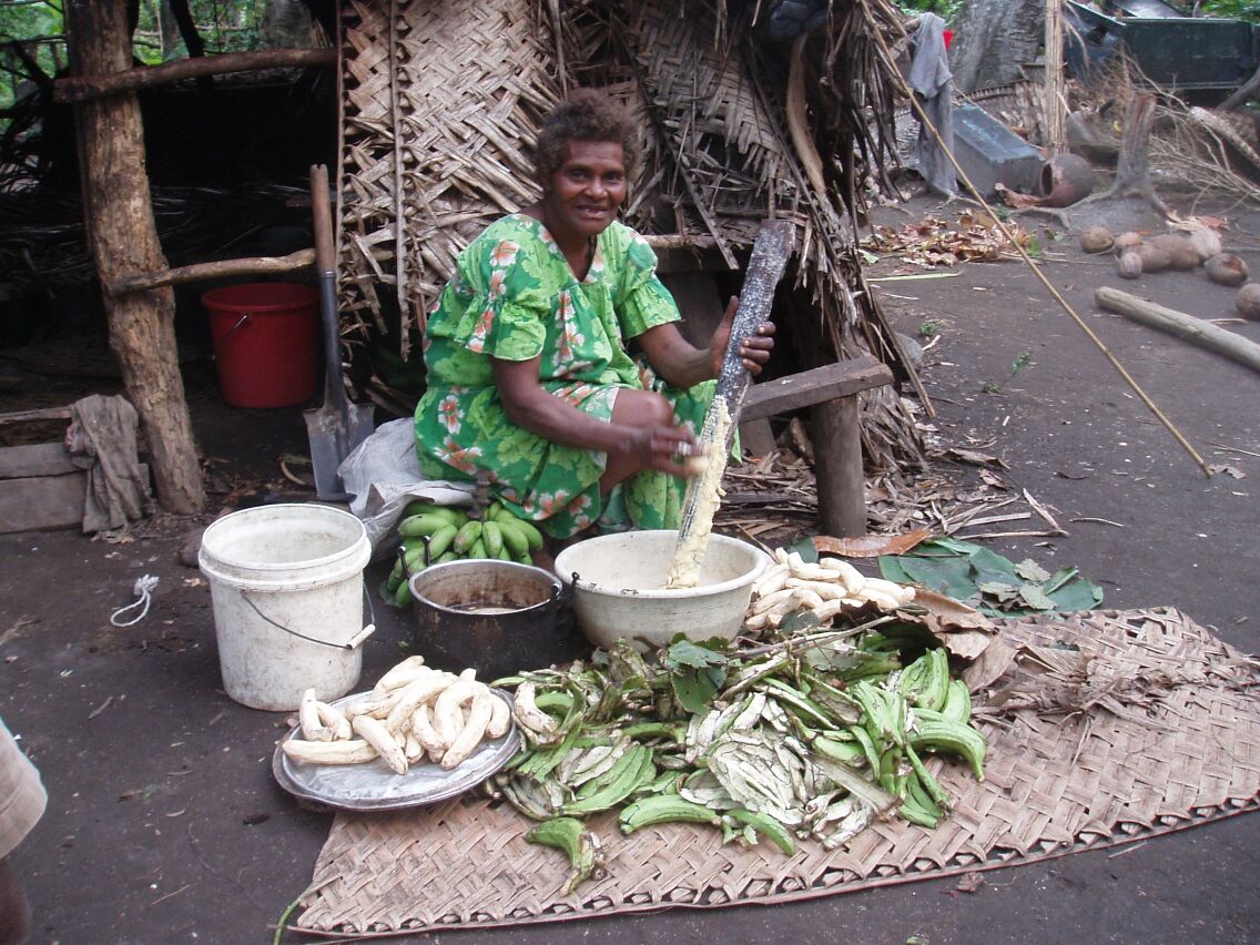
out - they used snorkel gear and spear guns, girls collecting firewood, small "machete toting" children collecting coconuts, pandanus mat weaving,
lap-lap making (local dish made from grated coconut, cassava, banana and possibly some form of ground meat, wrapped in banana leaf - baked in a
ground oven).
In the afternoon we ventured ashore on a mission to find the headmaster of the local school. He is a member of the council of chiefs and also runs a
breeding program for giant clams. The island of Uliveo is approx 1.3 miles by 0.5 miles and has a population of about 2,000 souls across 3 villages.
This makes it one of the most populous islands in the Vanuatu chain. The island does not seem able to support the present population and the
villagers have plantations for their crops on several of the neighboring islands. They commute back and forth by dugout canoe and we have seen such
crossings with the paddlers working very hard to make way against the wind. There is a wide trail that circumnavigates the island and can be
walked in a couple of hours. We took four hours to make this circuit, as just about every islander needed to introduce themselves, shake our hand
etc. plus everything needed to be photographed. The walk was indeed very interesting, as we saw just about every facet of village life, with people
performing their everyday activities. We saw copra production at 10 vatu per kilo - approx one third of the Fiji price. They were also drying some
kind of nut that was also used for producing oil and we observed was additionally being used for pig feed. There were chickens everywhere of
course and large pigs in pens with the smaller pigs outside and tethered by a foreleg. The dogs were very laid back and watched unemotionally as we
walked within inches of where they lay. I suspect that a genetic strain of vicious animal that bit villagers, would soon find itself going for a swim
in the lagoon with an attached rock. We passed canoe builders that were constructing new vessels and repairing old. They use a mixture of concrete
cement and raw sugar to caulk the canoes. This is claimed to be very strong and lasts a couple of years. We saw fishermen with their catch laid
out - they used snorkel gear and spear guns, girls collecting firewood, small "machete toting" children collecting coconuts, pandanus mat weaving,
lap-lap making (local dish made from grated coconut, cassava, banana and possibly some form of ground meat, wrapped in banana leaf - baked in a
ground oven).


The walk along the jungle trail itself was wonderful, as the trail was overhung with towering coconuts trees. In and around these were the bananas,
mangoes, ferns, banyans and lots of strange fruit and nut trees we could not identify.
We found the headmaster "Jack" and arranged with him to visit the clam reserve on the morrow at high tide - 1500 hours. The headmaster was
working on the construction of a "Custom" house, built in the traditional fashion but made very strong from huge logs. He claimed the finished
structure would provide a shelter for the villagers from the frequent cyclones.
Personally I would prefer reinforced concrete for protection from flying coconuts and storm debris. The island and village are very exposed on the
south east corner of Malakula Island with just reefs for wave protection. We did see several concrete homes on the island with solar panels etc. We
understand that these are for the use of Peace Corps volunteers, who were absent on vacation during our visit. Overall this was a more advanced
village from those we visited on Tanna. For example, the school had TV, DVD's, videos etc. and parts of the villages had power - for at least some
of the day - although by late evening the only lights to be seen were the anchor lights of DoodleBug and Freewind.
August 31, 2005
 Lazy morning catching up on chores. We need high tide to visit the giant clam reserve and that will be around 1500 hours. We dinghied
ashore and hiked through the villages at a fast clip, to meet Jack, headmaster of the local school, council member and director of the clam
reserve. The project was begun by Jack's father and is taken very seriously by the villagers. A portion of the lagoon has been allocated to
the giant clams and the boundary marked with poles thrust into the sea bed. The poles have a sprig of some kind of leafy plant lashed to the top,
in order to indicate the area is "taboo". There is a fine of "10,000 vatu plus a tusked pig" imposed upon a villager violating the taboo. This is a
severe fine and we were told has only been imposed once. The clam program is an attempt to repopulate the species throughout the area. The clams had
of course been harvested to near extinction in the past. With a viable and thriving concentration of clams in the reserve, they are now finding
juvenile clams beginning to reappear on the outlying reefs.
Lazy morning catching up on chores. We need high tide to visit the giant clam reserve and that will be around 1500 hours. We dinghied
ashore and hiked through the villages at a fast clip, to meet Jack, headmaster of the local school, council member and director of the clam
reserve. The project was begun by Jack's father and is taken very seriously by the villagers. A portion of the lagoon has been allocated to
the giant clams and the boundary marked with poles thrust into the sea bed. The poles have a sprig of some kind of leafy plant lashed to the top,
in order to indicate the area is "taboo". There is a fine of "10,000 vatu plus a tusked pig" imposed upon a villager violating the taboo. This is a
severe fine and we were told has only been imposed once. The clam program is an attempt to repopulate the species throughout the area. The clams had
of course been harvested to near extinction in the past. With a viable and thriving concentration of clams in the reserve, they are now finding
juvenile clams beginning to reappear on the outlying reefs.
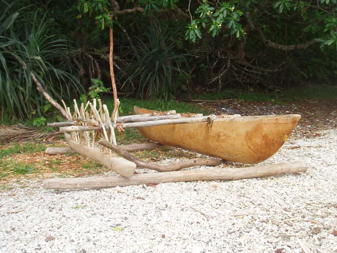
We loaded our snorkel gear into a large dugout canoe and helped push this down the beach into the sea. The canoe is made from a single, crudely
carved log, that has it's freeboard increased by the addition of planks butted to the gunwales. The seams between the log and the additional
planks are caulked with a cement / sugar mixture. The canoe was surprisingly heavy and was quite stable floating in the sea with its
outrigger. When it was loaded with six people, the water line reached the upper edge of the log - lower edge of the added on planks and I hoped we
would not be crossing rough water.

 We paddled across the lagoon to a small island and from there we slipped into the water to snorkel over the clam fields. Annette and I were
grateful for the "shorty" wet-suits we were wearing, as the sky was overcast and the wind blowing, making it feel quite chilly even though the
air temperature has been in the 78F (26 C) range.
We paddled across the lagoon to a small island and from there we slipped into the water to snorkel over the clam fields. Annette and I were
grateful for the "shorty" wet-suits we were wearing, as the sky was overcast and the wind blowing, making it feel quite chilly even though the
air temperature has been in the 78F (26 C) range.
The clams were just amazing, in that the shell looks like a dirty rock but the inner mantles are all different colors and hues. Some are
mottled, some have electric colors that just don't look real. If you swim near and get close, they will snap their shells closed (happened frequently to
Tarzan in the old movies). They were all the colors of the rainbow and I have found this puzzling as to why. One would expect them all to be the
same color for the same specie. They don't need the color as a sexual attractant, since clams don't do a whole lot of moving around. They don't
need to attract fish as they are sea water strainers, so why the color variation? (I, daughter and webmaster, contacted
the Houston Downtown Aquarium and asked the biologist. He said, "in a nut shell, the clams have bacteria
living in their flesh.") Whatever the reason, it made for a fine display. There were also sea cucumbers in profusion and a wide array of soft corals, fish and
other shell fish. Annette found what she thought was some kind of skull jammed under a piece of coral. When she extracted the item, it became a
very offended puffer fish that blew himself up into a balloon and stormed away as only a puffer fish can. We swam around the preserve until we ran
out of water and had to walk the final fifty yards or so back to our island and to our clothing, crunching along the top of the live coral
reef. This latter activity didn't seem appropriate for a wildlife reserve but I am sure future generations will work this one out.
After the tour, we walked back to our dinghy landing accompanied by headmaster Jack. He has visited several parts of the United States and was
up to date on the latest news via his satellite television, that he powers from solar panels at the school. He pointed out plants and trees on our
walk and explained the various uses. For example, possession of a small bouquet of the wild kava we have seen, prevents babies from having
nightmares. If carried with you on your walk, it prevents evil spirits from following you.
 It has been interesting to visit with the local populations who profess devout Christianity and yet have maintained a belief in evil sprits and black
magic. It reminded us that our society does the same thing, with practices such as "knocking on wood", throwing salt over our shoulder, not walking
under ladders, avoiding black cats passing our path etc. We really aren't so very different.
It has been interesting to visit with the local populations who profess devout Christianity and yet have maintained a belief in evil sprits and black
magic. It reminded us that our society does the same thing, with practices such as "knocking on wood", throwing salt over our shoulder, not walking
under ladders, avoiding black cats passing our path etc. We really aren't so very different.
Annette was stopped on our walk by a man who needed her to visit his daughter. We followed at a distance and watched as the daughter presented
Annette with a dress she had made. This is called by some a "Mother Hubbard" dress and is appropriate for wear to church. We have seen these
villagers dressed in rags that are falling from their bodies and are stunned by the generosity of people who have so little.
September 1, 2005
Position: 16 26.4 S 167 47.0 E
We planned to leave today on high tide in order to get through the double reef pass guarding the lagoon where we had anchored off the village of
Lutes on Uliveo Island. The tide tables indicated high tide at 1620 hours. A departure at this late an hour would have us arriving at our next
destination after dusk. Unacceptable!
 Annette and I set off in our dinghy with a portable depth sounder and surveyed the water depths between the reefs, zigzagging back and forth
through the waves, with Annette sprawled across the front of the dinghy yelling out the depths. We then reported to Freewind that we now knew how
to get out at low tide and both vessels raised anchor and braved the wind, waves and reefs again, weaving back and forth between the jagged rocks and
guided only by our steely sailors eyes and several billion dollars worth of satellites.
Annette and I set off in our dinghy with a portable depth sounder and surveyed the water depths between the reefs, zigzagging back and forth
through the waves, with Annette sprawled across the front of the dinghy yelling out the depths. We then reported to Freewind that we now knew how
to get out at low tide and both vessels raised anchor and braved the wind, waves and reefs again, weaving back and forth between the jagged rocks and
guided only by our steely sailors eyes and several billion dollars worth of satellites.
We motor sailed from the Maskelyne Islands to the main island of Malakula and anchored in Sandwich Bay at 16 26.4 S 167 47.0 E at about
the position that Captain Cook anchored. One of the notable features of Sandwich Bay is a reported giant shark that ate a 9 year old yachtie here
not long ago. There are posted signs warning of the danger of shark attacks. The locals claim that it is not really a shark but the spirit of
a particularly hostile ancestor. The fact that there are herds of cattle here and when the animals are slaughtered, the offal and carcass are
dumped in the sea, is of course not relevant.
We did go ashore very carefully, jumping well clear of the dinghy to the beach. We walked an hour or so to the former French administrative center
of the island at the village of Lamap. The school was still functional but only the shells of the other buildings remain. The power poles still line
the roads but there are no wires remaining and no electricity since independence was achieved 25 years ago. It is very sad to see the total
loss of infrastructure due entirely to ignorance and the inability to maintain even the simplest technology.


We found the local store who sold us bread and beer (the two basic food groups) and we ordered a truck for the morning to take us into the
interior to visit one of their primitive villages. The truck is supposed to pick us up from the wharf at 0400 hours. The guide book notes that the
last recorded case of cannibalism was on this island in 1969. Between the sharks and the cannibals, tomorrow promises to be an interesting day.
September 2, 2005
Position: 16 26.4 S 167 47.0 E
Yesterday we had visited Levi's store near Sandwich Bay, that the guide book alleged could make arrangements for us to travel to one of the
primitive "Little Namba" villages in order to see their dancing, woodcarvings etc. The store folks told us to be ready to be picked up at
0400hours on the wharf and we would return by 1400 hours. We were all up at 0300hours packing sandwiches, water, first aid kits, bug spray, sun
screen, trade goods etc. etc. Frank collected us from Doodlebug in his dinghy and deposited us at the wharf. The wharf was in total darkness
and we gazed at the stars and counted satellites (five found) as we waited. A particularly bright satellite I confidently identified as the
space station with the solar panels extended. Okay, so I made it up - but it could have been.
The truck didn't show at 0400 hours. We understood the system that operates in this part of the world, were not entirely surprised and thus
waited patiently. At 0525 hours, five minutes before we had planned to return to DoodleBug, the long awaited truck appeared, wet, muddy and
already stuffed with people and cargo. We rode to a beach further up the headland and then transshipped to a bobbing aluminum boat. The
passengers with their packages, children, chickens, sacks of vegetables, loaded aboard and we set off in the boat along the reef and into the
next bay. There were of course no life preservers of any kind and the people sitting on the cabin roof did not help the stability of this
overloaded and tiny craft.
We entered the relative calm of the next bay and saw large fins in the water within feet of us. Too big to be dolphins. As we passed amongst
them, we recognized the fins to be the wing tips of a school of giant manta rays and we could then see the huge bodies near the surface of the
water. The waves were breaking on the black sand beach that we were aiming for but the boat driver confidently drove his vessel onto the
sand and we scrambled ashore. We then proceeded to load 14 people, an amazing quantity of cargo and two chickens in to the bed of a half ton
Toyota four wheel drive diesel engine pick-up truck. We were packed tighter than sardines and clinging onto the sides of the truck and to
each other, as the truck swayed along the single lane dirt road, over ditches, river crossings and along the crumbling edge of sea cliffs. We
admired the trees, creepers, fruit bats, parrots, pigs, goats, waving natives, grass huts, sea views, rocks and mountains for the next two
hours, until the truck came to an abrupt halt. The driver pointed up an overgrown trail, heading at an angle up into the hills and stated that
we must now walk to the primitive village. It would take us three hours to hike it, he confidently announced. He could not pick us up again
today but would pick us up tomorrow at the road intersection.
This news was not received with a great deal of enthusiasm on our side. Frank is recovering from knee surgery and although he professed that he
could hike to the village, he also maintained he would need an ambulance to get back. Another problem was simply that the batteries on out boats
would need attention before tomorrow. We conferred and then told the driver we would continue with him to the next major town. This is the
town of Lakatoro and is now the "capital" of the island. An hour later we staggered off the truck and sat in the village square drinking beer
from the local store, until we had recovered enough to buy more.


Annette had noticed several young women entering a building with a sign saying "Restaurant". Although it was now 0800 hours, she convinced them
to open the restaurant to us at 0930 hours for "brunch". They promised us we could have the "special lobster" from the lunch menu. For the next
90minutes we wandered around town, in and out of the stores and visited the local market. There were two chickens for sale at the market but
Annette assured us they were not our fellow passengers from this morning. The copra store had nothing to offer but the cacao store gave
Annette a sample of the locally grown cocoa bean.
At 0930 we found the door of the restaurant open and finally got a lobster meal after weeks of ineffectively cajoling the locals. Sated
from a brunch of beer and lobster (two of the basic food groups) we moved to a sort of bus shelter. It was a large open concrete slab with a
roof. We all settled down for a post prandial nap using our backpacks for pillows and trying not to crush the uneaten sandwiches therein. This
was most welcome and only interrupted by the arrival of the headmaster "Jack" from the island of Uliveo. He had been attending a conference
nearby and was returning on the same truck as ourselves.
Our driver had assured us he would pick us up at 1300 hours and I was frankly astonished when he showed up near this time. We loaded the
little pick-up until it was bursting at the seams and badly over-laden. Then we added three more people and their luggage. The driver then
stopped on the road to pick up more customers but the existing passengers protested so loudly, that he gave up on the attempt. We had
to stop several times to readjust the pile of cargo that was heaped in the middle of the truck bed and was crushing the legs of anyone foolish
enough to try and sit "in" the truck as gravity rearranged the sedimentary layers. Three tortuous hours later we arrived back at the beach where we had originally landed. We
escaped from the truck and stretched our legs as we waited about an hour for the boat to arrive. We were hungry again and our crushed sandwiches
weren't exactly great but did hit the spot as we consumed them on the beach.
The boat finally arrived and we loaded everyone on board and the "amateurs" climbed onto the roof of the small forward cabin again. The
more experienced sailors knew what was going to happen, as the boat bullied it's way out into the bay against the incoming rollers. The roof
sitters were thoroughly soaked. When we arrived back at the far side of the bay, the truck that was to return us to the wharf was "hors de
combat" with a broken starter motor. This was no hardship as our cramped muscled still cried out for a walk. We arrived back on board Doodlebug
just as night was closing in and were both appreciative and grateful for our hot shower before bed.
September 3, 2005
Position: 16 08.4 S 168 07.0 E
We raised anchor this morning at 0900 hours and set sail for the island of Ambryn. The crossing was beautiful sailing, close reaching with blue skies,
sunshine and a view of Ambryn's erupting volcano, which was sending a plume of smoke towards the north west. We rounded the north west cape and
the wind switched tacks before finally dying in the lee of the sea cliffs.
As we now motored along the north coast towards our anchorage, we received detailed news by e-mail and satellite phone and finally discovered what
had happened to the City of New Orleans. Several days ago back in Uliveo, we had been told that a cyclone had hit the Louisiana coast of the United
States. Not exactly news this time of year. On the truck ride yesterday, we were again told that there were many deaths - but the US media always
screams "wolf" and we paid little attention to this. The dreadful news we now received, regarding the failure of the Lake Ponchatrain levee, cast a
pall over this beautiful day and we motored on below the pall being cast by the volcano.
We anchored off the village of Ranon and were instantly visited by 3 or 4 canoes. One canoe was from the nearby village of Fanla and the men were
promoting their village's custom dance. The price quoted was 4000 vatu per head, eight times the price on Tanna. This seemed excessive and one
presumes is due to the number of resorts on Ambryn. We declined the offer of dancing subject to later renegotiation of the price.
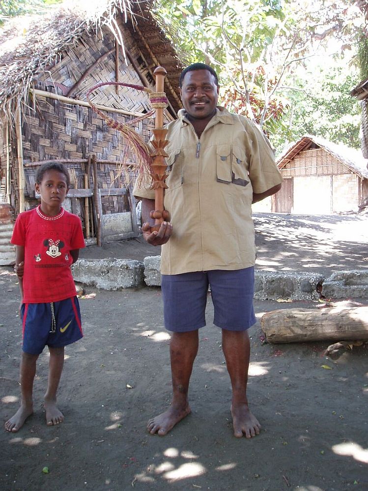
 We dinghied ashore to visit Ranon and met Samuel, a village elder and wood carver. He guided us through the village and we met the chief who is also
the local baker. This is a fascinating village to explore as just about everyone is a wood carver. Samuel's family has inherited the right through
the line of his grandfather to build a two headed tam-tam or drum. He explained that the chief can carve a tam-tam with five heads but if he did
this, he would be subject to a fine of 80,000 vatu and two tusked pigs. The society here is very complex with their hereditary rights. From the
1st. of September for several months, it is taboo (forbidden) to climb the volcano. This is so as not to anger the gods that control the yam crop. It
has been fascinating to see the meld of ancient religion with the current Christianity that the people practice assiduously. Of course we have the
same mixture in western society, if we care to examine the traditions of such holidays as Halloween, Christmas and Easter.
We dinghied ashore to visit Ranon and met Samuel, a village elder and wood carver. He guided us through the village and we met the chief who is also
the local baker. This is a fascinating village to explore as just about everyone is a wood carver. Samuel's family has inherited the right through
the line of his grandfather to build a two headed tam-tam or drum. He explained that the chief can carve a tam-tam with five heads but if he did
this, he would be subject to a fine of 80,000 vatu and two tusked pigs. The society here is very complex with their hereditary rights. From the
1st. of September for several months, it is taboo (forbidden) to climb the volcano. This is so as not to anger the gods that control the yam crop. It
has been fascinating to see the meld of ancient religion with the current Christianity that the people practice assiduously. Of course we have the
same mixture in western society, if we care to examine the traditions of such holidays as Halloween, Christmas and Easter.
 We walked on through the village and noticed a headstone on a grave for " Linda" aged 7. The memorial read "Shark Tragedy". Samuel commented
that only her head is buried in the grave, as that was all that was found. This sobering marker was in stark contrast to the villager's statement on
arrival of "not to worry" about sharks there. The guide book also warned of the shark danger off the black sand beaches. We found another headstone
as we walked around the village. It was particularly noticeable since it was being used to bridge a drainage ditch and everyone walked on it. The
inscription read, "Jean Francois Rossi, Ne a Letia (Corse) Le 5 Fevrier 1862, Mort Assassine par les natifs de Port Olery Ile Santo, Le
3 Aout 1895."Translates as "Jean Francois Rossi, Born at Letia (Corsica) on 5th. February 1862, Murdered by the natives at Port Olry, Island of
Espirito Santo, 3rd. August 1895. Apparently this was a rough place to be one hundred years ago and Jean's memory isn't held in such high regard by
the current inhabitants.
We walked on through the village and noticed a headstone on a grave for " Linda" aged 7. The memorial read "Shark Tragedy". Samuel commented
that only her head is buried in the grave, as that was all that was found. This sobering marker was in stark contrast to the villager's statement on
arrival of "not to worry" about sharks there. The guide book also warned of the shark danger off the black sand beaches. We found another headstone
as we walked around the village. It was particularly noticeable since it was being used to bridge a drainage ditch and everyone walked on it. The
inscription read, "Jean Francois Rossi, Ne a Letia (Corse) Le 5 Fevrier 1862, Mort Assassine par les natifs de Port Olery Ile Santo, Le
3 Aout 1895."Translates as "Jean Francois Rossi, Born at Letia (Corsica) on 5th. February 1862, Murdered by the natives at Port Olry, Island of
Espirito Santo, 3rd. August 1895. Apparently this was a rough place to be one hundred years ago and Jean's memory isn't held in such high regard by
the current inhabitants.


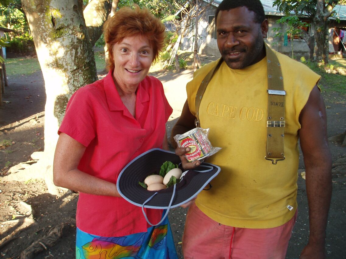
We traded for carvings and flutes etc. Annette traded a can of corned beef for three black bush duck eggs. These eggs were carefully wrapped in a
leaf and tied with a cord of pandanus - the local equivalent of a Styrofoam box. The ducks are some kind of Muscovy duck that digs its eggs
into the soft black volcanic sand and then relies upon the sun to incubate the eggs. According to the locals, these eggs are buried quite deep and
the chicks must dig their way out. Annette also traded a watch and a CD player for a local carving. This process is always fun to watch as we
carry surplus goods with us that the natives have no other access to. The trade items are passed from hand to hand amongst the villagers and examined in minute detail
before being returned.
Frank purchased a live pig from one villager. We arranged to have it slaughtered and cooked on the morrow for Sunday supper - without the head, intestines
etc... We got to select the one we wanted - a black pig about the size of "Babe".
September 4, 2005
More canoes showed up at dawn for trading or chatting. At least it wasn't dark when we answered the faint calls of "hello" from outside our sleepy nest.
We agreed to visit Jeffery, who's house is behind the "dead white tree" off the beach. We spent the morning doing chores and went ashore just
after noon to stretch our legs. We walked to the end of the beach and then the trail climbed steeply over the headland. Very pretty views but also
very hot work slogging uphill. Enough of this exercise stuff! We retraced our steps and discovered Jeffery's house as described. Here Annette
traded some beach towels, a sports bag and a 1000 vatu for a pig tusk and a breadfruit smacker. I didn't know that breadfruit needed to be smacked
but after roasting in a fire, they do somehow. We collected the loaf of
 bread we had ordered from the chief the day before and Annette then began to negotiate with Douglas for a walking stick and a flute. Here she traded
a CD player, a watch and some handkerchiefs. Everyone seemed happy with the trade but we have to return tomorrow to adjust the date and time on
the watch and give Douglas some Bob Marley CD's for him to listen to.
bread we had ordered from the chief the day before and Annette then began to negotiate with Douglas for a walking stick and a flute. Here she traded
a CD player, a watch and some handkerchiefs. Everyone seemed happy with the trade but we have to return tomorrow to adjust the date and time on
the watch and give Douglas some Bob Marley CD's for him to listen to.
 By now the pig was nearly finished cooking but Frank had seen Samuel's pig whacker and just had to have it. It was ornately carved and the only one
of it's kind in the village. Samuel had carved it and custom prevented anyone else from carving the ornamentation in the middle of the whacker.
Sort of like the Steelworkers Union. Frank made the complex deal and we headed back to DoodleBug clutching our walking sticks, pig whackers,
roasted pig, shoes, backpacks etc. etc. The pig was very tasty but much tougher than we are used to with our spoilt, grain fed, Western tastes.
By now the pig was nearly finished cooking but Frank had seen Samuel's pig whacker and just had to have it. It was ornately carved and the only one
of it's kind in the village. Samuel had carved it and custom prevented anyone else from carving the ornamentation in the middle of the whacker.
Sort of like the Steelworkers Union. Frank made the complex deal and we headed back to DoodleBug clutching our walking sticks, pig whackers,
roasted pig, shoes, backpacks etc. etc. The pig was very tasty but much tougher than we are used to with our spoilt, grain fed, Western tastes.
September 5, 2005
Even more canoes circled DoodleBug early this morning. Annette continues to trade for pig's tusks, flutes, statues, drums and breadfruit whackers. The
mistress is at work. She has four ongoing trades to complete that afternoon. I finally write down on a piece of paper the various deals, so
I at least can keep them straight. I need to set the time on the three watches she has traded and provide some CD's and AA batteries for the
three CD players traded. The new owners need something to listen to! These items were all in their original sealed packaging and have each been
traded to different people. I am praying that this stuff works until we are over the horizon. At least the sports bags and towels she traded don't
break. All in all the parties seem very happy with their deals.
In the afternoon we took a walk along the coast trail in the opposite direction to yesterday's hike. It was a very pretty walk, partly shaded by
the trees and with excursions along the black sand beaches. I have really enjoyed the absence of mosquitoes here and was told that it is the "dry
season". Dry or wet has not seemed to affect the little bloodsuckers on any of the other nearby islands we have visited. I believe that this
island would be a hiker's paradise if you could get a shower, a beer and a meal at the other end of the hike.


We will leave tomorrow morning for Luganville on Espiritu Santo, some 65 miles away. I did a departure check on the engine room and found the belt
on the engine's 24 volt alternator had shredded. I had several spares and the part was soon replaced. I now need to set up "secure" storage for
Annette's trading loot in the forward V-berth, to enable the load to travel undamaged during tomorrow's passage.
September 6, 2005
Position: 15 32.3 S 167 10.6 E
The Grib (.grb weather) files indicated a southeast wind of around 13 knots today. We planned a 65 mile broad reach to Luganville, on the Island of
Espiritu Santo and raised anchor at 0600 hours. We left the lee of Ambryn in a dead calm but as we motored out to sea, we expected the wind
to pick up. I had even rigged the port pole system to pole out the Genoa when needed. The wind never picked up and we motored all day in winds of
around three knots. We read books. Annette cut my hair and gave me a pedicure.


It was hot. Freewind motored on, less than a mile away. At 1430 hours we caught two tuna on the trolling lines and hauled them on board. Wrong
stripe pattern but we kept them anyway for future "gifting". At 1530 hours we picked up a mooring at Aore Resort opposite the port of
Luganville, position 15 32.3 S 167 10.6 E. The tuna were donated to S/V Titum who planned fish supper that evening. We however,
dinghied over to the resort dock and ate the steak and lobster special in their restaurant.
September 7, 2005
We arose this morning too late to take the resort ferry across the narrow strait to
Luganville. As the sea was calm, we crammed everyone into Doodlebug's dinghy and motored across the strait to the entrance of the Sarakate
river. We had a little difficulty seeing our way across the river bar but eventually found deeper water and dinghied on upstream to find a landing spot.
 Luganville was the largest base for US troops outside the United States during WW II. Some 100,000 servicemen were stationed here, together with
two fighter strips and three bomber fields. This was the staging area for the landings at Guadalcanal and Frank's father was sent here when he was a
young, 17 year old marine. Frank's father went on to fight all across the Pacific and was in the second wave ashore at Iwo Jima. Fortunately for
Frank, his father was one of three survivors in his company of 300 men.
Luganville was the largest base for US troops outside the United States during WW II. Some 100,000 servicemen were stationed here, together with
two fighter strips and three bomber fields. This was the staging area for the landings at Guadalcanal and Frank's father was sent here when he was a
young, 17 year old marine. Frank's father went on to fight all across the Pacific and was in the second wave ashore at Iwo Jima. Fortunately for
Frank, his father was one of three survivors in his company of 300 men.
Another celebrity who was here, was the author James Mitchener. He was stationed here when he wrote the novel "Bali Hai". The nearby island of
Ambae was supposedly the inspiration for the fictional island of Bali Hai. The Hollywood producers who shot the movie based on the book, had
originally intended to shoot the movie here but then switched to Bora-Bora in French Polynesia. The reason for the switch was supposedly that the
Melanesians of Vanuatu look too much like American Negroes and they thought that the European looking Polynesians would be far more acceptable
to a 50's American audience.
The current town was essentially just a huge military base and when the US army left, the previous inhabitants simply abandoned their dwellings and
moved their existing town of "Luganville" into the empty buildings. Many of the old Quonset huts still stand. We dinghied past Unity park near the
mouth of the Sarakate river. This was where John F. Kennedy's PT-109 was based before his transfer to the Solomons. We walked through town, looking
at all of the shops until we arrived at the immigration office at the other end of town. We updated our visas and chatted to the immigration
official. As we left, the man thanked Frank for his father's assistance during the war. We moved onto the customs office to "check in" and then
headed back downtown to find an internet cafe. After fifteen minutes of sitting in front of a computer screen, I had been unable to successfully
access a single web-site, so we gave up and went to find lunch.
September 8, 2005
We tried to use the internet facility at the Aore Resort but were denied access until 1100 hours, whilst they used "the" computer for their accounting. In
the meantime, Annette and I took a very pleasant walk around the island. Just before lunch, we were finally able to access the internet and pay
bills, review accounts etc. Next task was boat chores, as I had several equipment filters to change and we collectively decided we could use a
"rest" day.
September 9, 2005
We had planned to travel to "Million Dollar Point" this morning to snorkel. This is a beach to the west of Luganville. The US army offered the
equipment such as trucks, generators etc. for sale at cents on the dollar to the returning French authorities after the war. The French declined as
they assumed they would get the surplus equipment for nothing, as it was hardly needed back in the USA and they assumed the departing Americans
would just abandon it. They were discomfited to find that the incredible mass of surplus war material was simply bulldozed into the sea by the US
army. This equipment is in relatively shallow water and is a popular snorkel and dive site.
Frank had been experiencing battery charging problems and the previous evening, Peter on S/V Adamant II had offered to help him. Peter is a
retired navy electrician and it seemed too good an opportunity to pass over. By the time we were ready to go snorkeling, the sky was overcast and
threatened rain. Yes...you do get wet anyway when you snorkel but you also need reasonable light to see stuff. Since it was now Friday afternoon, we
dinghied over to Luganville to "check out" with Customs before the week-end began and obtain our departure documents for Port Vila.
September 10 2005
This morning was snorkel day and again we awoke to grey skies and rain. Movie day! We vegged out all day reading books and watching videos. In the
evening we managed to waddle over to Freewind to eat pizza with Frank and Jan.
September 11, 2005
Another cloudy morning but maybe the hint of blue sky here and there. We delayed our decision until around 1100 hours, when the sun seemed like it was
making an effort to show up for the day. We loaded snorkel gear into our dinghies and again made the pilgrimage to Luganville. Upon our arrival on
the beach, we flagged a taxi and had the driver take us out to the "Million Dollar Point." What a trip! This is the ultimate man made
attraction.
There were bulldozers, trucks, big guns, a gutted ship, Quonset huts, tires, wheels, half tracks, engine blocks, big metal things.....all accessible
from the beach. The coral was taking over of course and there was the "usual" wild profusion of colors, starfish, fish of all shapes and sizes.
It would have been great to spend several days here. Reluctantly we clambered back in our taxi for a tour of other WW II remnants.
The next stop was the "blue hole" - a pristine lake of clear bluish spring fed water. Annette immediately found a baby fruit bat that was laying on the
ground in distress. She tried to place it in a tree but it was too weak to hold on. She tried to warm and hydrate the little thing, while we made
muttering noises about rabies. The taxi driver assured us that he would try to feed the creature and release it. No way we could do anything for
it by taking it to New Caledonia and breaking a dozen international regulations.
She reluctantly parted with her rehab project. We visited a bomber field, saw an abandoned aircraft engine from a crashed plane, saw ammunition
bunkers etc. Interesting but all paled next to the underwater extravaganza at Million Dollar Point.
September 12, 2005
Position: 16 26.3 S 167 47.0 E
We slipped our mooring early this morning and set sail for Port Vila, some 165 miles to the southeast. Unfortunately this is also the direction of
the prevailing winds and not an easy direction to go with a sailing vessel. Yesterday we had pored over the wind forecasts and sail angles,
trying to determine the best strategy. It had seemed that we would be close hauled in light winds until around noon, when the wind would get
even lighter and we might be forced to motor. Our past experience regarding the accuracy of wind forecasts (Grib files) was not great but we
poor souls never entirely give up hope.....
We emerged from the shelter of Aore Island and found the wind stronger than expected but the angle was OK and we sailed on close hauled. The crew
of DoodleBug does not care for this point of sail. The Genoa and Main sails are both sheeted very tight and the boat heels to around 15 degrees
from vertical. This makes every simple action such as using the toilet or opening the refrigerator a challenge. The direction also means the waves
are coming at us from ahead and we cut through and over them with a jerky, hobby horse action. We also take a lot of water on deck as the bow plunges
through the occasional breaking wave, sending sheets of "green" water across the deck.
We were making good progress averaging 7 knots or more as we sailed down the length of Malakula Island. In the early afternoon the wind began to
increase in strength slightly and the waves began to build. We were sailing at 8 knots plus and looking forwards to the next waypoint where we
would bear off 10 degrees and we could go to a "close reach" - a fast point of sail and slightly more comfortable. Another 12 miles and we would
get another 13 degrees wind angle and a "beam reach". This promised a fast overnight sail to Port Vila on Efate. Just three quarters of a mile from
the eagerly anticipated waypoint, the wind dropped abruptly to less than two knots, leaving just the confused breakers. We were quite close to
Sandwich bay on the southern end of Malakula and we turned in here and anchored for the evening at 16 26.3 S 167 47.0 E.
Annette rejoined the living as soon as we entered the calm of the bay and fixed a great supper of fried chicken, salad with feta cheese stuffed
peppers, corn and beans etc - home style cooking! Dessert was Australian fruit cake and desert wine and all was shared with Frank and Jan. They had
arrived on S/V Freewind in the dark at 1900 hours and were guided to their anchorage by the wonders of GPS and a low technology flashlight waved from
the deck of DoodleBug.
September 13, 2005
Position: 17 44.8 S 168 18.6 E
We raised anchor at 0830 and set sail for the island of Emae. This lies 50 some miles further south and is about half way between Sandwich Bay and Port
Vila. The island of Emae has an anchorage on the west coast, that provides reasonable protection from the prevailing southeasterlies and is a popular
overnight stop. The Grib (weather) files predicted an easterly airflow of around 5 knots by noon today - perfect for a quiet night!
We began our trip to Emae with sunshine and 14 knots of wind from the north. This gave us a comfortable, fast beam reach and around 1500 hours
we caught a fat 24 inch tuna, that was unceremoniously hauled aboard. Fish supper tonight!

 We arrived off the beach at Emae an hour later, to see whitecaps all the way up the sand and 3 foot rollers sweeping the anchorage. No stopping here
tonight! None of the other nearby anchorages had looked good for a late night arrival, so we switched to our back-up plan to continue to Port Vila
on Efate - 58 miles to the south. We had good waypoints for this harbor entrance, the navigation markers were working and we could anchor in the
quarantine anchorage. The tuna was stuffed into the fridge on top of the few remaining beers and we sailed on.
We arrived off the beach at Emae an hour later, to see whitecaps all the way up the sand and 3 foot rollers sweeping the anchorage. No stopping here
tonight! None of the other nearby anchorages had looked good for a late night arrival, so we switched to our back-up plan to continue to Port Vila
on Efate - 58 miles to the south. We had good waypoints for this harbor entrance, the navigation markers were working and we could anchor in the
quarantine anchorage. The tuna was stuffed into the fridge on top of the few remaining beers and we sailed on.
At 1840 hours we passed through a line of showers and as expected, the wind shifted direction. What we did not expect was that it switched to the south and we
were now motoring into a headwind directly on the nose. Fortunately the wind began to drop about an hour later and finally died away to a dead
calm, leaving just a very confused sea.
We made an entrance to the inner harbor at Port Vila at midnight, using GPS, radar and binoculars, to find an anchorage amongst the vessels
awaiting customs clearance. We weaved in and out of some thirty darkened vessels, with Annette on the bow shining a flashlight and trying to
quietly yell directions at each other, so as not to wake our potential neighbors. Fat chance! Freewind arrived about forty minutes later and added to the
general cacophony by anchoring nearby. We are currently moored at Port Vila at 17 44.8 S 168 18.6 E
September 14, 2005
Early this morning we raised anchor and moved from the quarantine area to the inner harbor, picking up a mooring off the yacht club. Annette cleaned
yesterday's tuna on the rear step of the boat, liberally coating herself and the stern of DoodleBug with fish blood, while I tidied away lines. A
panga with two locals motored by and Annette called and waved them over. They were surprised and delighted with the gift of the fish she had just
cleaned. We had a date with Freewind that evening to barbeque steak (Vanuatu is famous for it's beef) and we did not see getting to the tuna
very soon. The rest of the morning was spent ferrying all of our accumulated souvenir purchases to a local store in Vila called "Goodies".
They had agree to pack and airmail our "stuff" to the USA for us. Doesn't sound too exciting but I was delighted. The thought that upon our return
to the USA in November, we would NOT have to schlep all of these fragile items, on and off international flights, buses and rent cars, was one the
highlights of the week.
September 15, 2005
Today we checked in with the Customs officials. We should have done this yesterday but it is so tedious and we just lied about our arrival time. The internet
had been "down" for all of Port Vila yesterday but was working today. I took the opportunity to look at the "blogs" (web logs - try
www.captainsquartersblog.com) about the New Orleans fiasco and to look at the new Amel 54 on Amel's website www.amel.fr.
September 16, 2005
First thing this morning was a trip into town to visit Immigration and get our passports stamped for departure. Then we split tasks with Annette off to
the grocery store and me back to Customs to get departure documents. I also had to pay fees to the Harbor master and was very cognizant of the
fact that they all closed offices at 1130 hours for a two hour lunch break. As I mentally screamed at the Harbor master to just take my money
and give me the g....m receipt! Frank was at the Customs office directly below where I stood, picking up his documents verrry slowly, so they
couldn't close up and leave. Fortunately it worked and we left with our clearance papers and certificates allowing us to purchase duty free diesel
(I hadn't paid for yesterday's fill-up yet) plus duty free booze.
 Lunch and then the liquor store. By the time we were finished paying all of our bills and had the booze safely stowed on board, it was nearly
sunset and the crews of Freewind and DoodleBug met at the bar at the nearby yacht club. One round of drinks and we were down to 400 vatu in
cash (about US$4) between the four of us. A good state of affairs since you can't change vatu out of the country.
Lunch and then the liquor store. By the time we were finished paying all of our bills and had the booze safely stowed on board, it was nearly
sunset and the crews of Freewind and DoodleBug met at the bar at the nearby yacht club. One round of drinks and we were down to 400 vatu in
cash (about US$4) between the four of us. A good state of affairs since you can't change vatu out of the country.
September 17, 2005
Position: 20 55.1 S 167 16.7 E
0400 hours. We slipped our mooring under a full moon and slowly eased our way out of the crowded anchorage bound for the Loyalty Islands. It took about
an hour to clear the harbor entrance markers and as we headed down the bay, we had the fun of dodging inbound unlit local ferries or returning
fishing boats. We could see them on radar and they would sometimes yell a warning at us, or wave a dim flashlight, as we passed them in the night.
Dawn found us beam reaching under full sail with clear sunny skies on course for Lifou. Frank on Freewind called me on the VHF to say his steering pump
was failing and would not hold course. He had to take in his sails and motor to reduce the load on the pump. This was a real pity, as the sailing
conditions were ideal - however his pump continued to function as he motored.
We lost the wind around 1700 hours and motor sailed on through the night, with the wind reasserting itself but in the opposite direction at 0300
hours. Now there was a thin layer of cloud obscuring the moon and we beam reached to the island of Lifou, arriving at We harbor at 0700 hours. We
are currently moored at Position 20 55.1 S 167 16.7 E

 At dawn on Saturday, the wind had increased and we had enough light and "awake" crew members, to fool around on deck setting the light weather
sails. We spotted Frank on the horizon three miles away. We also found a trapped halyard at the top of the mast. It took the best part of an hour to
free this and rig our Genoa, poled to port and our spinnaker (actually a "ballooner") poled to starboard. The engine was shut down and we were under
sail for the first time, at 6.3 knots with 10 knots of true wind from the stern. The radar was blank. Freewind was now nowhere to be seen. Our radio
check-in at 0900 hours showed that Frank was 11 miles behind DoodleBug, as he had "heaved to" to sort out his own jammed halyard and in the process
had knocked his deep-sea fishing pole over the side. Not a happy camper!
At dawn on Saturday, the wind had increased and we had enough light and "awake" crew members, to fool around on deck setting the light weather
sails. We spotted Frank on the horizon three miles away. We also found a trapped halyard at the top of the mast. It took the best part of an hour to
free this and rig our Genoa, poled to port and our spinnaker (actually a "ballooner") poled to starboard. The engine was shut down and we were under
sail for the first time, at 6.3 knots with 10 knots of true wind from the stern. The radar was blank. Freewind was now nowhere to be seen. Our radio
check-in at 0900 hours showed that Frank was 11 miles behind DoodleBug, as he had "heaved to" to sort out his own jammed halyard and in the process
had knocked his deep-sea fishing pole over the side. Not a happy camper!